MANILA, Philippines — The Philippine Atmospheric, Geophysical and Astronomical Services Administration (PAGASA) reported that the easterlies will bring cloudy skies with isolated rains across multiple regions of the country, including Metro Manila,CALABARZON,MIMAROPA,Bicol Region,Visayas, and Mindanao. These conditions are expected to persist throughout the week, affecting daily activities and travel plans.
According to PAGASA’s latest forecast, the easterlies — warm winds originating from the Pacific Ocean — are currently the dominant weather system. They are causing partly cloudy to cloudy skies with isolated rain showers or thunderstorms, especially in the afternoon or evening. The public is advised to stay alert for possible flash floods or landslides during severe thunderstorms.
What Are the Easterlies?
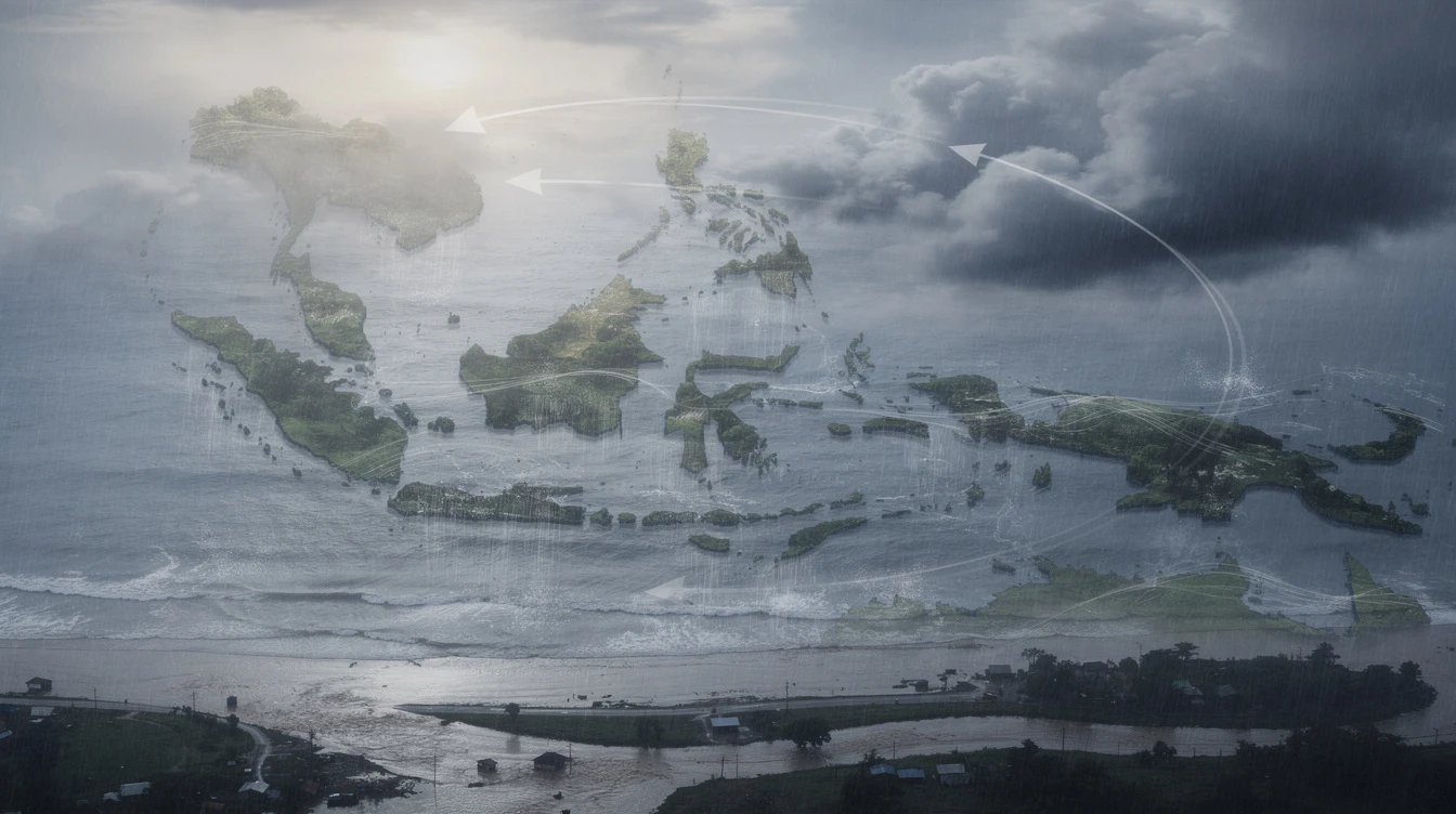
The easterlies are winds that blow from the east, passing through the Pacific Ocean before reaching the Philippines. They typically bring warm and humid air, which can trigger cloud formation and rain. Unlike typhoons, easterlies do not have a defined center but can still produce significant rainfall when combined with other atmospheric factors.
For Filipinos, understanding the easterlies is crucial because they are a common weather pattern during the transition between monsoon seasons. They often lead to unpredictable weather, with sunny mornings giving way to sudden afternoon downpours.
Affected Regions and Forecast Details
Regions Under Easterlies Influence
As of PAGASA’s 4 a.m. bulletin, the following areas will experience cloudy skies with isolated rains:Metro Manila,CALABARZON,MIMAROPA,Bicol Region,Visayas, and Mindanao. These regions can expect partly cloudy to cloudy skies with isolated rain showers or thunderstorms.
Meanwhile,Caraga,Eastern Samar, and Southern Leyte may experience scattered rains and thunderstorms due to the easterlies, according to PAGASA weather specialist Veronica Torres.
Northern Luzon Update
The rest of Luzon, including Batanes,Ilocos Norte,Apayao, and Cagayan, will have partly cloudy to cloudy skies with isolated light rains. A frontal system is also affecting Batanes, bringing scattered rains and isolated thunderstorms. Wind speeds in Northern and Central Luzon are light to moderate, moving southeast to south, with slight to moderate coastal waters.
Heat Index Concerns
Despite the rains,PAGASA warned that the heat index could reach 41 degrees Celsius in Metro Manila, falling under the “extreme caution” category. The highest heat index was recorded in Negros Occidental at 44 degrees Celsius. This means heat cramps and exhaustion are possible, and the public is urged to stay hydrated and avoid prolonged sun exposure.
Public Safety Advisory
PAGASA advised residents in affected areas to remain vigilant. Flash floods or landslides may occur during severe thunderstorms, especially in low-lying and mountainous regions. The agency recommended monitoring local weather updates and preparing emergency kits.
“We advise the public to take precautionary measures, especially during thunderstorm occurrences,” said Torres. “Avoid crossing flooded areas and secure loose objects that might be blown by strong winds.”
Impact on Daily Life
The cloudy skies and rain may affect commuters, farmers, and outdoor workers. In Metro Manila, sudden downpours could cause traffic congestion and flash floods in flood-prone areas like EDSA and Marcos Highway.
For fishermen, the slight to moderate coastal waters provide relatively safe conditions, but isolated thunderstorms could pose risks. Farmers in agricultural regions like Central Luzon and Mindanao may benefit from the rains, as they help irrigate crops without causing severe flooding.
Expert Analysis
Weather specialist Veronica Torres highlighted that the easterlies are typical for this time of year. “We are seeing a combination of easterlies and a frontal system, which enhances rain over some areas,” she said. The public should not expect a typhoon-level threat, but localized flooding remains possible.
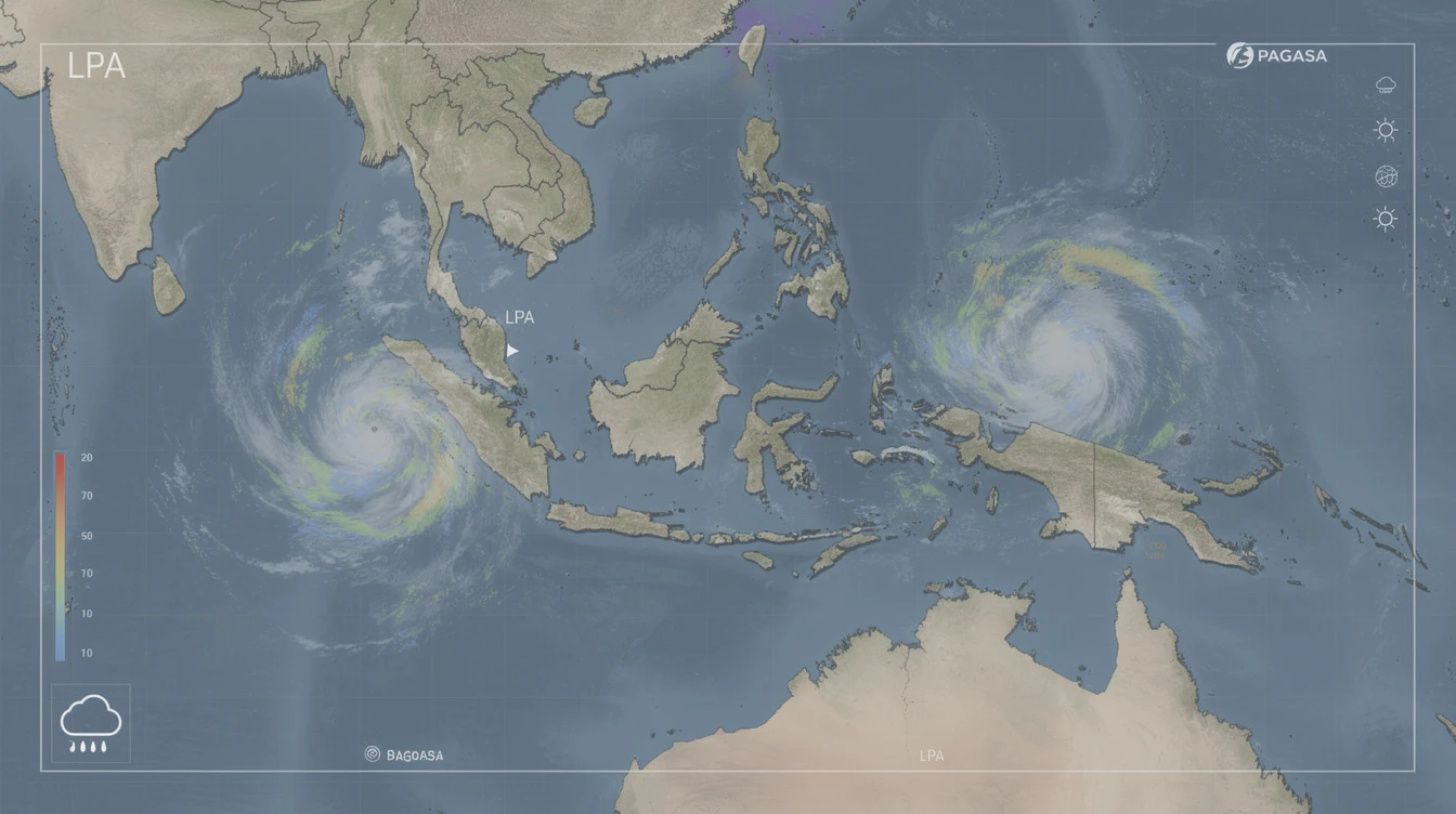
Meanwhile,PAGASA continues to monitor any potential weather disturbances. As of now, no low-pressure area or tropical cyclone is forecast to enter the Philippine Area of Responsibility in the coming days.
Outlook for the Coming Days
The easterlies are expected to persist, bringing similar weather conditions across the country. By the weekend, Metro Manila and other affected areas may still experience isolated thunderstorms in the afternoon. PAGASA advises checking daily forecasts and being prepared for sudden weather changes.
For long-term planning, the transition from the dry season to the rainy season typically begins in late May. The easterlies play a key role in this shift, gradually increasing the frequency of rain events.
Conclusion
The easterlies are bringing cloudy skies and isolated rains across much of the Philippines, with the risk of flash floods in severe thunderstorms. While no major weather disturbance is imminent,PAGASA urges the public to stay informed and practice safety measures. As the country transitions to the wet season, these weather patterns will become more common, making it essential for Filipinos to adapt and prepare.
For more updates on weather and other news, visit [PinoyPulse.com](https://pinoypulse.com).
Frequently Asked Questions
What is the difference between easterlies and monsoon?
Easterlies are winds from the east, bringing warm and humid air from the Pacific. Monsoons are seasonal wind shifts that bring heavy rains (habagat) or dry air (amihan). Easterlies are typical in spring and early summer.
Will there be a typhoon this week?
According to PAGASA, no low-pressure area or tropical cyclone is expected to enter the Philippine Area of Responsibility in the next few days. The current weather is due to easterlies and a frontal system.
How can I stay safe during thunderstorms?
Avoid open areas, stay indoors, and avoid using electrical appliances. Avoid crossing flooded streets. Secure loose objects at home. Monitor PAGASA’s official updates for real-time warnings.