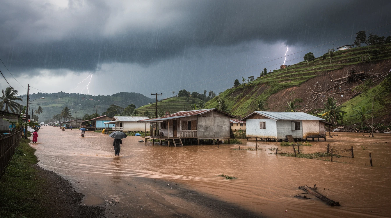
The Philippine Atmospheric, Geophysical and Astronomical Services Administration warned Monday that severe localized thunderstorms may trigger flash floods or landslides in parts of the country.
PAGASA's 4 p.m. weather forecast indicated isolated rain showers will persist through afternoon and evening hours nationwide.
"Localized thunderstorms may still trigger isolated rain showers, particularly in the afternoon or evening," stated the weather bureau in its official bulletin.
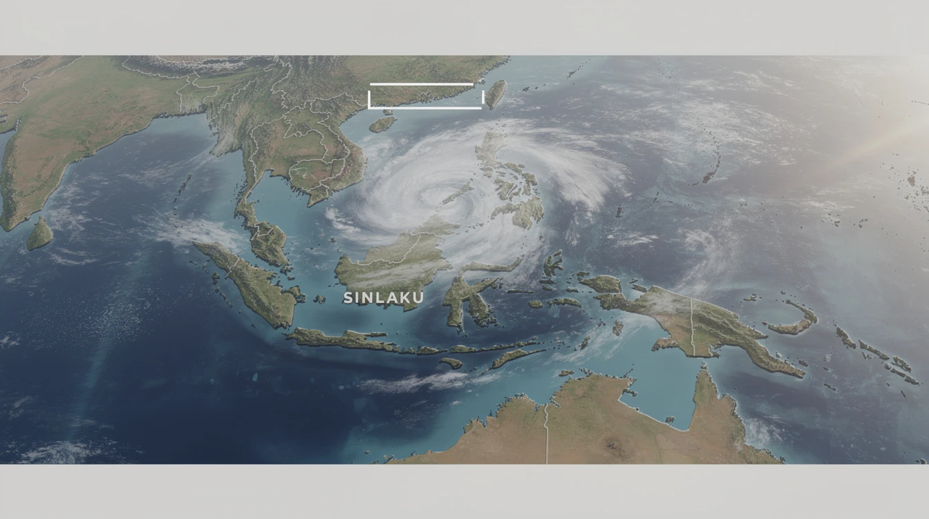
Meanwhile, Tropical Depression Sinlaku was located approximately 2,480 kilometers east of Central Luzon as of 3 p.m., remaining outside the Philippine Area of Responsibility.
The distant weather system currently poses no direct threat to Philippine landmass, according to meteorological monitoring.
However, PAGASA emphasized that locally developed thunderstorms present immediate danger to communities across archipelago.
"Severe thunderstorms may trigger flash floods or landslides," the agency cautioned in its public weather advisory issued Monday.
Residents in low-lying areas and near mountain slopes were advised to remain vigilant during afternoon downpours.
The weather bureau's hydrometeorological division continues monitoring watersheds and river systems for potential overflow.
Local government units have been alerted to prepare evacuation plans for flood-prone barangays nationwide.
This warning comes as many regions experience simultaneously high heat indices during daytime hours.
The combination of extreme heat followed by sudden heavy rainfall increases landslide risks in geologically vulnerable areas.
PAGASA's climatology division notes this pattern is typical during transitional periods between dry and wet seasons.
Metro Manila and surrounding provinces should expect partly cloudy to cloudy skies with isolated thunderstorms.
Similar conditions prevail across Luzon, Visayas, and Mindanao according to regional weather forecasts.
The state weather service recommends checking official channels for thunderstorm advisories before afternoon travel.
Fisherfolk and small sea craft operators are advised to exercise caution due to potentially sudden weather changes.
No tropical cyclone wind signals have been raised as Sinlaku remains distant from Philippine waters.
However, the bureau continues tracking the system's potential movement toward PAR in coming days.
Emergency management agencies have prepositioned response teams in historically flood-affected communities.
The Department of Public Works and Highways has deployed quick response units for possible road clearing operations.
"We urge the public to monitor official PAGASA updates and heed local government warnings," stated a disaster agency spokesperson.
This weather scenario particularly affects outdoor workers, farmers, and transportation sectors across islands.
Agricultural extensions advise farmers to secure harvests and implement drainage preparations for afternoon rains.
The Philippine context makes this weather pattern especially significant for several reasons affecting millions.
First, localized thunderstorms frequently cause urban flooding in major cities like Manila, Cebu, and Davao.
Second, OFW families often worry about relatives living in landslide-prone provinces during sudden downpours.
Third, the agricultural sector sustaining food security remains vulnerable to unforecasted severe weather events.
Finally, the distant tropical depression requires monitoring as many Filipino seafarers work in international waters.
This dual weather situation—immediate thunderstorm threats plus distant cyclone monitoring—demonstrates Philippines' complex climate vulnerability.