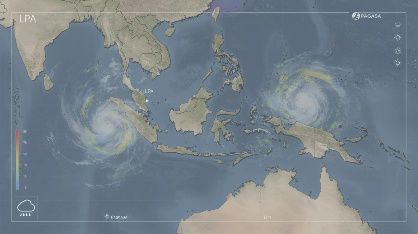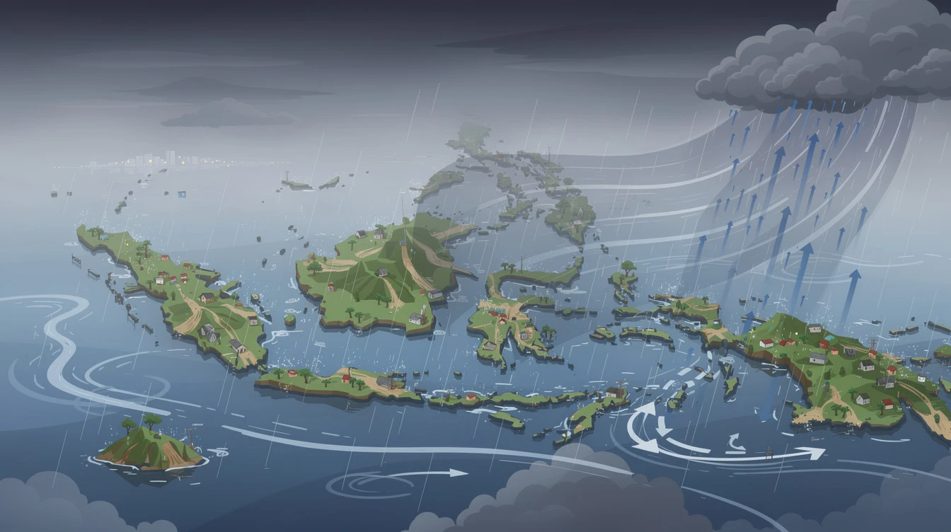
The easterlies are back, bringing cloudy skies and isolated rains over parts of the Philippines, particularly in Southern Luzon, Visayas, and Mindanao. This weather pattern, driven by winds from the east, has prompted the Philippine Atmospheric, Geophysical, and Astronomical Services Administration (PAGASA) to issue advisories for potential flash floods and landslides during severe thunderstorms.
For residents in these regions, especially those in low-lying and mountainous areas, it's a time to stay alert. The easterlies, while not a strong weather system like a typhoon, can still cause significant disruptions and hazards when combined with local conditions.
Easterlies
The easterlies are warm, moist winds that blow from the east, originating from the Pacific Ocean. They are a common weather phenomenon in the Philippines, especially during the summer months. When they interact with landmasses, they can trigger the formation of clouds and rain showers.
PAGASA describes the easterlies as a weather system that brings cloudy skies with isolated rain showers or thunderstorms . Unlike the monsoon, which brings widespread and prolonged rain, the easterlies produce more localized and often sudden precipitation.
Based on PAGASA's latest bulletin, the following areas are expected to experience cloudy skies and isolated rains due to the easterlies:
- Southern Luzon, including the Bicol Region, CALABARZON, MIMAROPA
- Visayas
- Mindanao
- Metro Manila (partly cloudy to cloudy with isolated rains)
Bring
The rest of Luzon, particularly Central Luzon and Northern Luzon, will also have partly cloudy to cloudy skies but due to localized thunderstorms, not the easterlies directly. PAGASA noted that the ridge of a High Pressure Area (HPA) is extending over eastern sections of Northern and Central Luzon, which influences these conditions.
PAGASA has issued a clear warning: during severe thunderstorms, there is a possibility of flash floods or landslides . This is especially true for areas that are already saturated from previous rains or have steep terrain.
"The rest of Luzon will have partly cloudy to cloudy skies with isolated rain showers or thunderstorms due to localized thunderstorms with the possibility that flash floods or landslides will occur during severe thunderstorms," PAGASA said in a statement.
This advisory applies not only to Luzon but also to affected areas in the Visayas and Mindanao. Residents in low-lying and mountainous communities should stay vigilant and monitor local weather updates.
For Northern Luzon, the wind speed is forecast to be light to moderate and moving in a southeast to south direction. Coastal waters in these areas will be slight to moderate , making sea travel generally safe but with caution for small boats.
In other parts of the country, particularly coastal areas in the Visayas and Mindanao, wind conditions may vary. Mariners and fishermen should check PAGASA's regular bulletins for specific outlooks.
For those planning outdoor activities, here are the sunrise and sunset times for the day: Sunrise at 5:37 a.m. and Sunset at 6:12 p.m. This provides a relatively long daylight period, but with the threat of isolated showers, it's best to have a backup plan.
While the easterlies are the primary driver for rain in the south, the rest of Luzon will experience isolated rain showers or thunderstorms due to localized thunderstorms . These are typically caused by the heating of the land surface during the day, leading to the formation of cumulonimbus clouds.
Localized thunderstorms can be just as dangerous as those brought by larger weather systems, with sudden heavy downpours and gusty winds. PAGASA advises the public to seek shelter immediately when a thunderstorm approaches.
The easterlies have been a recurring topic in Philippine weather news, especially during this time of year. For millions of Filipinos in the affected regions, the impact can be significant:
- Farmers may need to adjust planting or harvesting schedules due to unexpected rain.
- Commuters, especially in Metro Manila and other urban centers, may face traffic jams caused by sudden downpours.
- Tourists planning beach trips or island tours should check weather updates and avoid travel during thunderstorm warnings.
Local government units (LGUs) are also encouraged to prepare emergency response teams and ensure drainage systems are clear to minimize flooding. PAGASA's role in providing timely and accurate forecasts remains crucial for public safety.
Visayas,
As the easterlies persist, cloudy skies with isolated rains will continue over the coming days. While there is no indication of a tropical cyclone at this time, the weather pattern may shift. PAGASA will continue to monitor conditions and issue updates as needed.
For now, residents and visitors in the affected areas should stay prepared. Keep an umbrella or raincoat handy, monitor local news, and follow advisories from authorities.