The Philippine Atmospheric, Geophysical and Astronomical Services Administration reported Friday that the former super typhoon Sinlaku has weakened into a typhoon while moving away from the Philippine Area of Responsibility.
PAGASA stated Sinlaku is no longer a direct threat to the country but its influence contributes to the prevailing weather pattern.
Weather Specialist Benison Estareja confirmed "cloudy skies with light to moderate rains and isolated thunderstorms" will persist across most regions.
The state weather bureau's forecast indicates the habagat or southwest monsoon enhanced by Sinlaku will affect Western Visayas and Palawan.
Metro Manila and the rest of the country can expect partly cloudy to cloudy skies with isolated rain showers or thunderstorms.
Estareja warned the public of possible flash floods or landslides during severe thunderstorms, especially in low-lying areas.
Sinlaku previously intensified into a super typhoon over the Pacific Ocean before weakening as it approached remote U.S. islands including Guam.
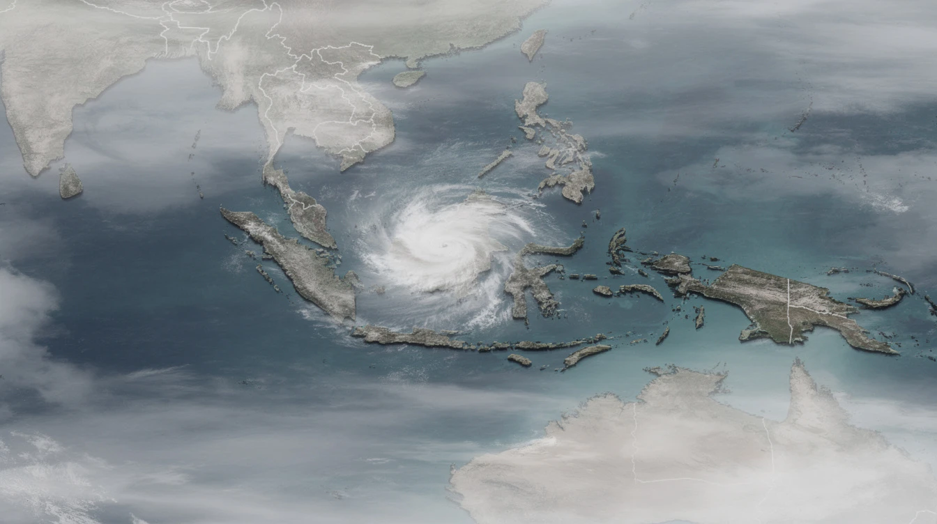
The Joint Typhoon Warning Center recorded the storm with sustained winds of 150 mph at its peak intensity earlier this week.
While the typhoon is moving away from Philippine territory, its residual effects continue to influence local weather conditions.
PAGASA monitoring shows the typhoon is now located approximately 2,300 kilometers east of Extreme Northern Luzon.
"The cyclone's outer rainbands, combined with the enhanced southwest monsoon, are the primary drivers of our current rainfall pattern," Estareja explained.
The weather forecaster noted that isolated coastal areas might experience higher rainfall accumulation in the coming days.
Fisherfolk and small sea craft are advised to remain cautious due to potentially rough sea conditions.
Local government units have been alerted to prepare for possible localized flooding in vulnerable communities.
Sinlaku's transformation from super typhoon to typhoon status follows a typical weakening pattern as such systems encounter less favorable conditions.
PAGASA records indicate an average of 20 tropical cyclones enter the Philippine Area of Responsibility each year.
The weather bureau continues to monitor another low-pressure area developing east of Mindanao that might intensify.
Residents in flood-prone areas are reminded to stay updated with official weather bulletins from PAGASA.
For Filipino communities abroad, particularly in Guam and neighboring Pacific islands, the typhoon serves as a reminder of similar weather hazards back home.
Many overseas Filipino workers in affected areas have reported taking precautionary measures as the storm approached.
The Philippine Consulate General in Guam issued advisories to the Filipino community regarding emergency preparedness.
Families of OFWs in typhoon-prone regions expressed relief that Sinlaku weakened before making landfall near populated areas.
This weather development holds particular significance for the Philippines as the nation remains in the peak of typhoon season.
The transition of Sinlaku from super typhoon status demonstrates how rapidly these weather systems can change intensity.
Filipino readers should note that even distant typhoons can influence local weather through enhanced monsoons and peripheral effects.
The continued rainfall across the archipelago underscores the interconnected nature of weather systems in the Pacific region.
Preparedness remains crucial as the country anticipates more tropical cyclones in the coming months of the rainy season.