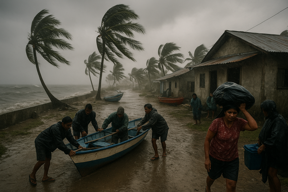
Tropical Depression Wilma may have lost its intensity, but the storm’s lingering effects continue to batter the Bicol and Eastern Visayas regions with relentless rainfall and flood threats. As of December 7, the system has weakened into a low-pressure area, yet heavy rain tied to the storm’s remnants and an active shear line poses an ongoing hazard for millions across southern and central Philippines.
Weakened System Still Delivers Dangerous Rainfall
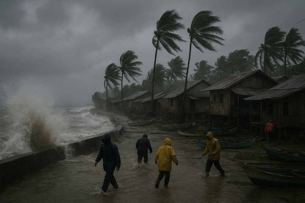
Initially identified as a low-pressure system over the Philippine Sea, Wilma was officially named a tropical depression by PAGASA on December 5, positioned approximately 235 kilometers east of Borongan City, Eastern Samar. The system tracked slowly southwest, making landfall over Dolores, Eastern Samar on December 6. While it never reached tropical storm strength, Wilma’s volume of rainfall became its most destructive trait.
Presently downgraded from cyclone status, Wilma has degraded into a remnant low-pressure area, located west of the Visayas. Still, authorities warn that the system’s rainbands are combining with a persistent shear line—a zone where warm and cold air masses collide—to dump torrential rains over parts of Eastern Samar, Leyte, Northern Samar, and Bicol.
Flooding, Landslides Plague Vulnerable Regions
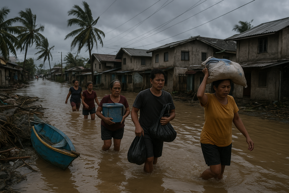
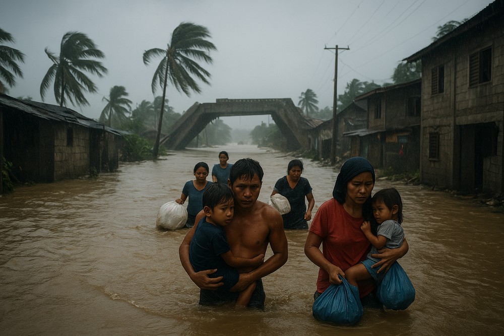
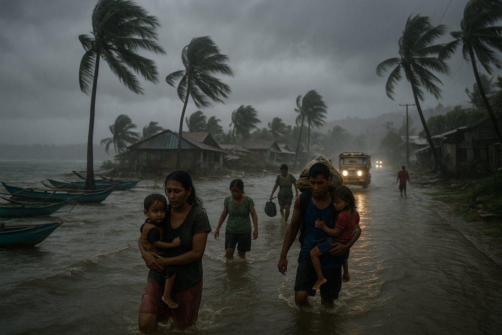
Despite its weakening, Wilma continues to swamp communities with rainfall measuring between 100 to 200 millimeters in some areas. Localized flooding and landslides have been reported, particularly in low-lying and mountainous barangays across Eastern Visayas and Bicol. Authorities raised red flags over a growing number of high-risk municipalities where rivers swelled and roads became impassable.
“Wilma remains a tropical depression as it moves across the Visayas, bringing continuous rain that could cause flooding and landslides,” a PAGASA weather official warned during a December 7 press briefing. The shear line, a notoriously dangerous yet often overlooked meteorological phenomenon, is amplifying this rainfall even as the storm’s winds weaken.
disaster Readiness Ramps Up
With inundations mounting, the National Disaster Risk Reduction and Management Council (NDRRMC) has elevated its alert status to BLUE, indicating moderate risk. Local government units received advance projections showing vulnerable lands and have initiated preemptive evacuations in areas at highest risk. Relief agencies have also been deployed, as emergency operations move into high gear.
“Even though Wilma has weakened, the shear line is still active, producing significant rainfall over Bicol and Eastern Visayas, thus the threat remains for localized floods and landslides,” said meteorologist Robert. Rescue teams have been stationed in readiness across provinces where soil saturation has made the terrain unstable.
Forecast: Possibility of Re-Strengthening
Looking ahead, meteorologists are tracking Wilma’s remnants as they cross the Sulu Sea toward Palawan. Should the system gain new strength in the West Philippine Sea, a resurgence of tropical depression intensity is possible—though not guaranteed. PAGASA is urging continuous monitoring.
In tandem, the shear line will continue to activate intense rainfall in the Visayas and southern Luzon, even if Wilma’s remnants dissipate. This blending of weather systems remains particularly hazardous due to its sprawling reach, despite lacking the dramatic wind patterns of a stronger storm.
Understanding the Unseen Danger of Shear Lines
Unlike the eye of a storm—often portrayed as the central menace—rain bands and atmospheric features like shear lines can extend weather impacts tens or even hundreds of kilometers beyond a storm core. This pattern was evident with Wilma, where rainfall far exceeded expectations based solely on wind strength.
“People should not focus only on Wilma’s center when assessing risk,” a PAGASA spokesperson said. “It’s the widespread rain and danger of landslides that makes even a weakening storm life-threatening.” Experts stress that slow-moving tropical depressions may cause worse damage than faster, more powerful systems, thanks to sustained precipitation over vulnerable terrain.
Key Numbers at a Glance
- Rainfall: 100–200 mm in Eastern Samar, Leyte, and parts of Bicol
- Peak Wind: Tropical Depression strength
- Landfall Location: Dolores, Eastern Samar on December 6
- Current System Status: Remnant low-pressure area
- NDRRMC Alert Level: BLUE (moderate risk)
Conclusion: Storm Weakens, but the Risk Remains
Though Tropical Depression Wilma has diminished in power, its impact endures as heavy rainfall and weather anomalies continue to threaten central and southern Philippines. The combination of a persistent shear line and remnant low-pressure activity promises more rain in the days ahead.
With the storm’s potential to reorganize in the West Philippine Sea and communities already on edge from flooding, residents are advised to stay vigilant, heed official advisories, and prepare for any escalation. The focus now shifts from wind speeds to water levels—proving once again how the quiet tail of a storm can be far more damaging than its roaring front.