A tropical depression has formed east of the Philippines but remains outside the country’s Area of Responsibility, according to the Philippine Atmospheric, Geophysical and Astronomical Services Administration (PAGASA), which said the system poses no immediate threat to land.
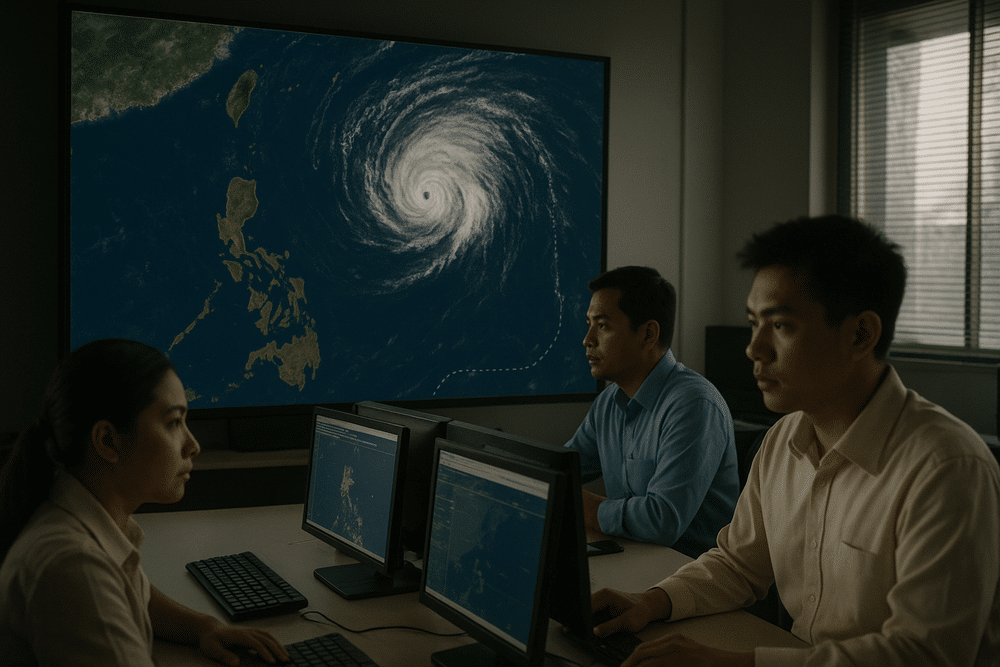
At 8:00 a.m. on 12 March 2026, Tropical Storm “Nuri” weakened into a tropical depression while positioned approximately 1,365 kilometers east of Eastern Visayas. The weather disturbance is being closely monitored, though officials have not raised any warning signals.
Weakened System Drifts South
PAGASA reported that the system carries maximum sustained winds of 55 kilometers per hour, with gusts reaching up to 70 kph. It is moving southward at 10 kph, a relatively slow pace that meteorologists say warrants observation but not alarm.
“As of 8:00 AM today, 12 March 2026, Tropical Storm ‘NURI’ has weakened into a Tropical Depression and is being monitored outside the Philippine Area of Responsibility (PAR),” PAGASA said in its advisory.
The agency reaffirmed the storm’s status in its 10:00 a.m. 24-hour tropical cyclone formation outlook, confirming that the system remains beyond the country’s monitoring boundary.
No Immediate Impact on Communities
Because the depression is outside PAR, it is not currently affecting weather conditions across the Philippine archipelago. No heavy rainfall, flooding, or wind-related disruptions have been reported in Eastern Visayas, Mindanao, or other regions.
For residents of coastal and agricultural communities — particularly in Samar, Leyte, and parts of Mindanao — the development serves more as a prompt to stay informed than a call to immediate action. Fisherfolk and farmers, often the first to feel the effects of approaching weather systems, have not been advised to suspend activities.
There have also been no reported economic disruptions, and no local government units have activated disaster response measures.
Monitoring Under National Law
PAGASA’s vigilance is mandated under Executive Order No. 292, which requires the agency to issue severe weather bulletins to safeguard public welfare. Meanwhile, the National Disaster Risk Reduction and Management Council (NDRRMC) stands ready to coordinate should the system enter PAR, in accordance with Republic Act No. 10121, the Philippine Disaster Risk Reduction and Management Act of 2010.
The Philippines sits squarely within the Pacific typhoon belt, one of the world’s most active cyclone corridors. Even early-season disturbances are tracked carefully, as weather systems can rapidly intensify over warm ocean waters.
A Reminder of Seasonal Vigilance
Although the depression currently poses no danger, its formation underscores the near-constant churn of tropical systems in the western Pacific. Like a storm gathering breath over open water, such disturbances can change character quickly depending on atmospheric and sea-surface conditions.
For now, PAGASA has issued no warning signals and forecasts no immediate threat to land. Authorities advise the public to continue monitoring official updates should the system alter its track or intensity in the coming days.
As of Wednesday morning, the message from forecasters is measured and clear: watchful, but calm.


