PAGASA on Tuesday said it is closely monitoring a low-pressure area (LPA) outside the Philippine Area of Responsibility (PAR), even as Tropical Depression Ada continues to drift away from land and weaken over the Philippine Sea. The weather agency stressed that no tropical cyclone wind signals are in effect nationwide, and that Ada is expected to further lose strength as dry air from the northeast monsoon suppresses its circulation.
Ada Drifts East, Weakening Over Open Waters
In its latest afternoon bulletin, PAGASA said the center of Tropical Depression Ada was located about 970 kilometres east of Northern Luzon, moving eastward at around 25 kilometres per hour. The system carries maximum sustained winds of 55 kph, with gusts reaching up to 70 kph.
Despite being far offshore, Ada’s wind field remains broad, with strong winds extending up to 400 kilometres from the centre. Still, forecasters said the storm is steadily losing organisation.
“Continuous dry air from the northeast monsoon is expected to weaken the system further, with PAGASA predicting it may be downgraded to an LPA,” the agency said in its advisory.
No Wind Signals, but Rough Seas Persist
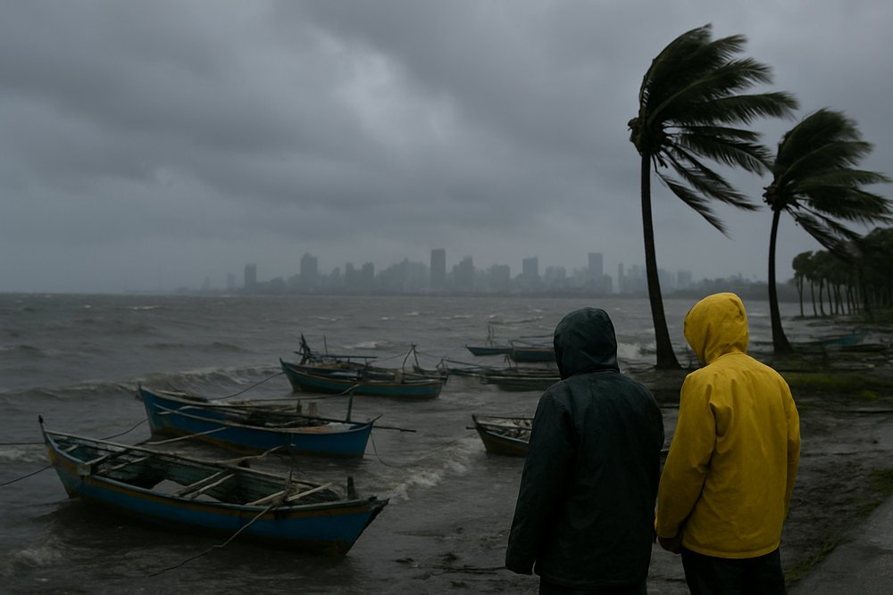
PAGASA confirmed that zero tropical cyclone wind signals are currently raised across the archipelago, as Ada no longer poses a direct threat to land areas. However, this does not mean calm weather.
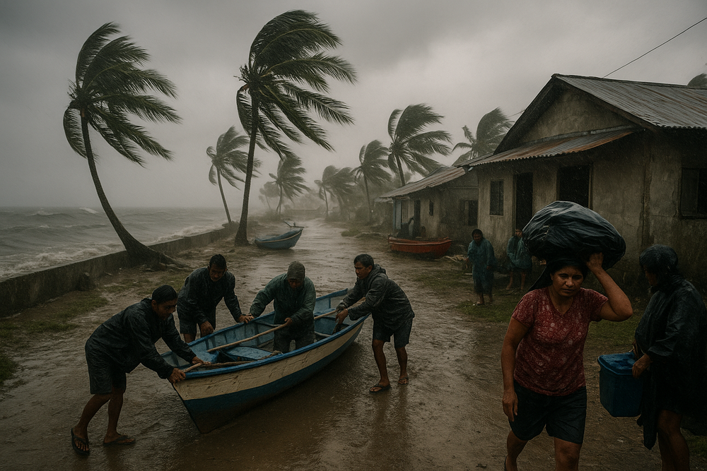
The northeast monsoon continues to dominate conditions, producing gale-force winds over northern and central Luzon, parts of the Visayas, and sections of Mindanao. Coastal and elevated areas—from Batanes and Cagayan to Samar, Leyte and the Zamboanga Peninsula—are experiencing strong to near-gale winds, keeping seas hazardous for small boats.
Cloudy skies with light to moderate rains persist over provinces such as Cagayan, Isabela, Aurora, Quezon and Marinduque, while Metro Manila remains largely overcast with minimal disruption to daily routines.
A Separate LPA Under Watch Beyond PAR
Apart from Ada, PAGASA said it is also monitoring another LPA located outside the PAR. While the system remains distant, forecasters are keeping it under surveillance due to the season’s changing wind patterns.
Earlier this month, PAGASA had warned of potential disturbances forming during January. A weather expert noted then: “In first week January, might be-pressure area with a chance of a tropicalone in Sulu.”
On a separate LPA candidate, forecasters assessed a “medium or around 50 percent chance of becoming a [LPA],” underscoring the uncertainty that often defines weather systems at this stage.
From LPA to First Storm of 2026
Ada itself began as an LPA east of Mindanao earlier this month. On January 14, when it was about 755 kilometres east of Davao City, the disturbance intensified into the Philippines’ first tropical depression of 2026, prompting the issuance of Tropical Cyclone Wind Signal No. 1 in six provinces.
The system failed to strengthen further and has since been steered away from the country by prevailing winds—an outcome PAGASA said was aided by the intrusion of dry, cool air from the northeast.
Everyday Impact: Fisherfolk and Farmers Feel the Strain
While Ada is fading, its indirect effects—and those of the monsoon—continue to ripple through daily life. Fisherfolk and small boat operators remain among the most affected, with rough seas forcing many to stay ashore, delaying fishing trips and tightening supplies in local markets.
In parts of the Visayas and Mindanao, particularly elevated and coastal communities, persistent winds raise concerns about landslides and transportation disruptions for agricultural goods such as rice and copra. So far, authorities report no significant flooding or storm damage.
Authorities Urge Vigilance Despite Low Threat
PAGASA said it will continue issuing regular bulletins and maritime warnings under its mandate, reminding the public that even weakening systems and distant LPAs can interact with the monsoon to produce dangerous conditions.
For now, Ada is expected to drift farther into the Philippine Sea and fade into a remnant circulation—a storm unraveling like a loosening knot over open water. But with another LPA under watch, forecasters stress that January’s weather remains unsettled, and vigilance is still required.