Tropical Depression Basyang has dissipated into a low-pressure area (LPA), the Philippine Atmospheric, Geophysical and Astronomical Services Administration (PAGASA) announced early February 7, easing the immediate cyclone threat but leaving behind a swath of heavy rains, dangerous seas, and more than ₱1.42 billion ($25.24 million) in estimated damage across the Philippines.
The weather disturbance, internationally known as Penha, weakened over the Sulu Sea at around 2 a.m. after crossing several landmasses in Mindanao and the Visayas. Though no tropical cyclone wind signals remain in effect, PAGASA warned that the system’s remnants — compounded by the northeast monsoon and an active shear line — will continue to bring intense rainfall to large parts of Luzon, Visayas and Mindanao in the coming days.
Weakened by Land Interaction After Five Landfalls
PAGASA said Basyang lost strength after making five landfalls, beginning at 11:50 p.m. on February 5 in Bayabas, Surigao del Sur. The system barreled through parts of the Visayas on February 6 before weakening into a tropical depression and eventually degenerating into an LPA.
In a recorded update, PAGASA explained:
“Update po muna tayo dito kay Bagyong Basyang na sa ganap na 2 a.m. po ngayong araw ay naging low pressure area na nga lamang dahil sa interaction nga dito sa mga land masses sa may Visayas at Mindanao. Nagkaroon nga po ng limang landfall itong si Bagyong Basyang. Una po noong Thursday, 11.50 p.m. sa may Bayaba, Surigao del Sur.”
At its peak prior to weakening, Basyang packed maximum sustained winds of 65 km/h and maintained a central pressure of 1000 hPa. By 4 a.m. on February 7, the LPA’s center was located 105 kilometers southeast of Cuyo, Palawan, moving west-northwest at 25 km/h.
PAGASA added: “Yung centro po nitong si low pressure area o yung dating si Bagyong Basyang ay huli po nating namataan kaninang alas 4 ng umaga dito sa 105 kilometers southeast ng Cuyo.”
Heavy Rains Persist Despite Dissipation
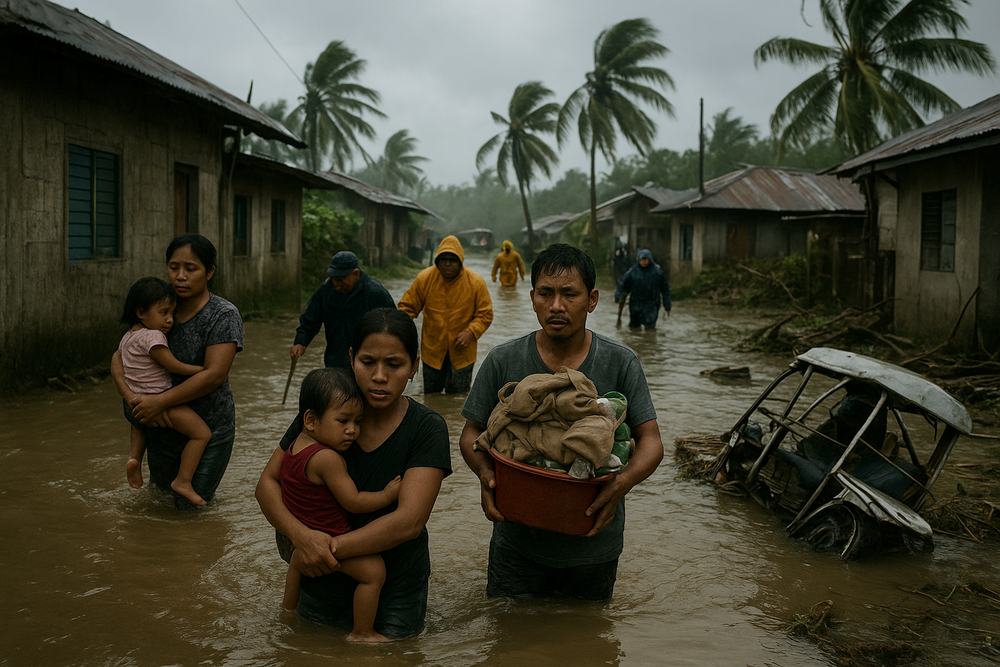
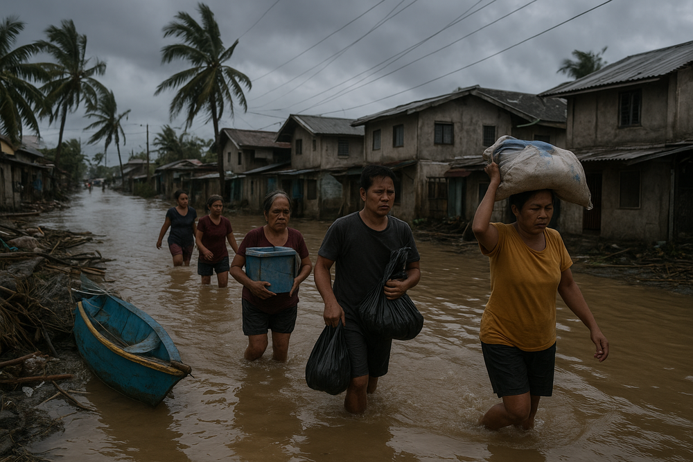
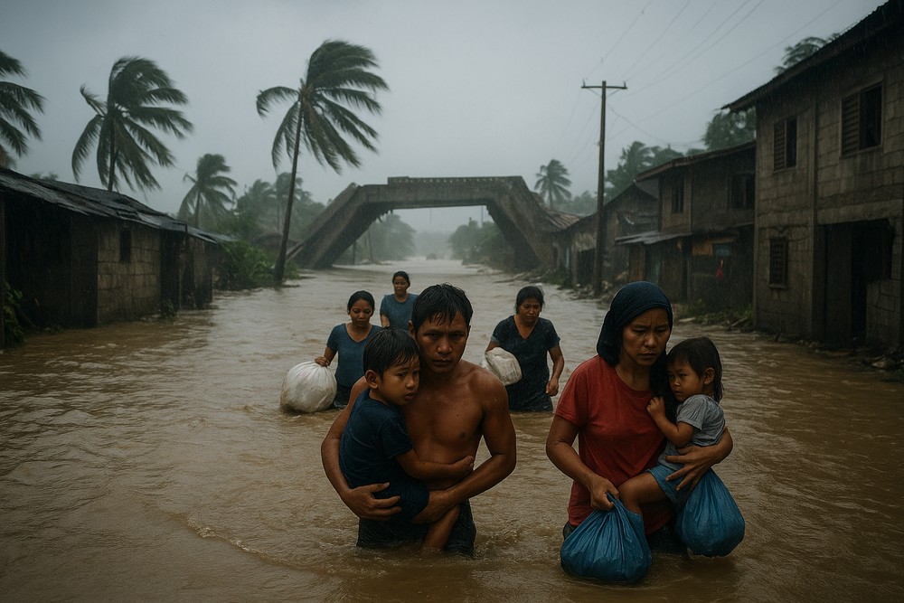
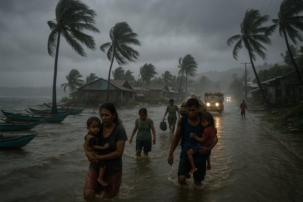
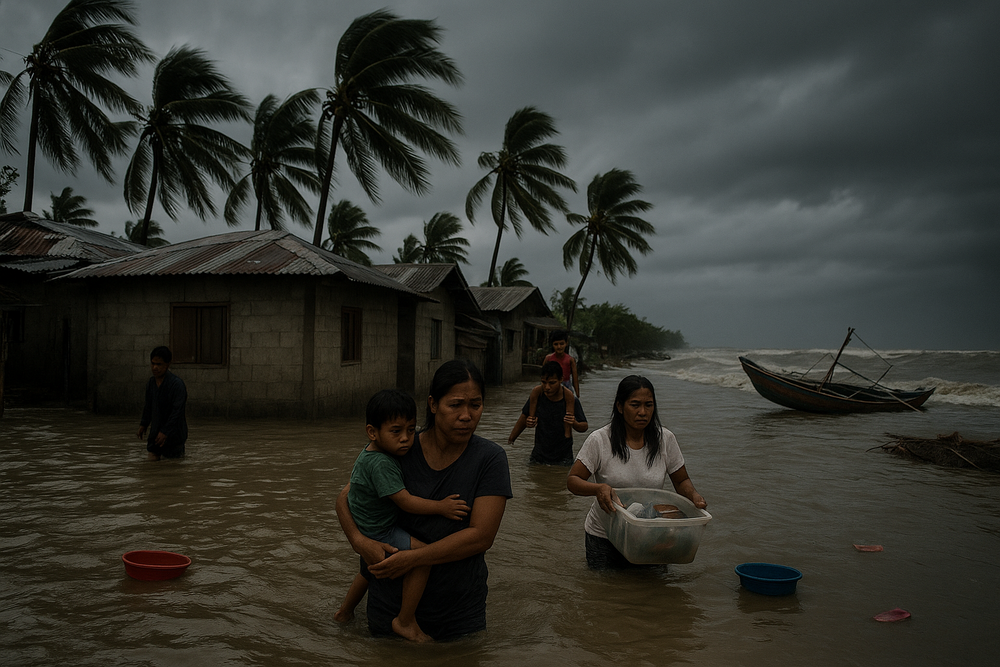
The storm’s downgrade offers limited comfort for communities still coping with flooding, landslides and transport disruptions. Like a river that continues to swell after the rain has stopped, the LPA’s circulation — together with the northeast monsoon and shear line — continues to fuel widespread rainfall.
From February 7 to 9, PAGASA forecast significant rainfall over:
- Large portions of Luzon
- Western Visayas and the Negros Island Region
- Zamboanga del Norte
- Northern and Eastern Samar, Biliran, northern Cebu, and Negros Occidental
Looking ahead to February 9–11, the agency warned that the shear line may dump heavy rains over southern Luzon, eastern Visayas, Bicol Region, MIMAROPA, and Calabarzon.
“Maghanda po yung ating mga kababayan dahil yung shearline na ina-expect natin dito ay malalakas din po yung dalang mga pag-ulan. So prepare na lamang po tayo especially dito sa may eastern Visayas area, Bicol region, Mimaropa and parts ng Calabarzon,” PAGASA said.
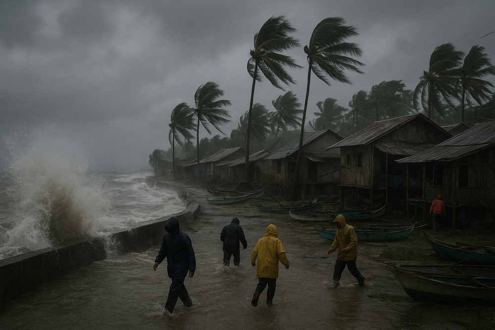
Dangerous Seas, Travel Disruptions
Even as winds subside over land, sea conditions remain perilous. PAGASA reported very rough seas up to 5 meters off Batanes and 4.5 meters off the northern Babuyan Islands. Rough to moderate seas persist over much of northern Luzon, the Visayas and eastern Mindanao.
The agency advised mariners, especially those operating small vessels such as motorbancas, to avoid venturing out. The Philippine Coast Guard has echoed alerts in affected areas, citing risks to sea travel and fishing activities.
Rising Toll: Fatalities and Damage
Although the system never intensified into a severe storm, its repeated landfalls left a measurable mark. Authorities have reported 12 fatalities and an estimated ₱1.42 billion in agricultural and infrastructure damage across the archipelago.
Flooded highways disrupted the transport of goods from Mindanao and the Visayas, while rough seas stranded fishing communities. Power interruptions and school suspensions compounded disruptions, hitting daily wage earners particularly hard.
Under Republic Act No. 10121, the Philippine Disaster Risk Reduction and Management Act of 2010, PAGASA is mandated to monitor tropical cyclones and issue public warnings. Local government units across affected provinces have activated response mechanisms in coordination with national authorities.
Communities Brace for Continued Rainfall
For many communities, the storm’s official dissipation marks only the end of one chapter. Rivers remain swollen, soils saturated and coastal waters unsettled — conditions that heighten the risk of secondary hazards.
While the absence of active wind signals signals a downgrade in immediate threat, PAGASA’s advisories stress continued vigilance. As residual rains sweep across southern Luzon and the Visayas, local officials are urging residents in flood- and landslide-prone areas to remain alert.
Basyang may have unraveled into an LPA over the Sulu Sea, but its wake — etched in damaged homes, battered crops and disrupted livelihoods — lingers far longer than the storm’s name on the weather map.