Shear Line Brings Rains, Flood Risks to Luzon
MANILA — A weather system known as a shear line is drenching wide swaths of Luzon, bringing days of steady rain, strong winds and the threat of flash floods and landslides to vulnerable communities, according to the Philippine Atmospheric, Geophysical and Astronomical Services Administration (PAGASA).
The system, created by the collision of the cold northeast monsoon or amihan and warmer easterly winds from the Pacific Ocean, is expected to affect eastern sections of Northern and Central Luzon through the weekend. Authorities have warned residents in low-lying and mountainous areas to remain vigilant as rainfall continues.
“Today and over the next three days, we can expect continued rainfall linked to this weather pattern,” PAGASA meteorologist Leanne Loreto said.
A Collision of Winds, A Band of Rain
A shear line forms when two opposing air masses meet, forcing warm air to rise and cool rapidly — much like steam condensing when it hits a cold surface. The result is a long, narrow band of clouds capable of producing widespread rain.
PAGASA explained that the current conditions stem from cold monsoon winds pushing down from the northeast and colliding with moisture-laden air streaming in from the Pacific.
“The northeast monsoon extends nearly to the Visayas at its lower section, where we can identify the axis of the shear line. This marks the area where the northeast winds meet the easterly winds,” said PAGASA meteorologist Loriedin de la Cruz-Galicia.
The weather bureau noted that such interactions often result in prolonged rainfall rather than the intense but short-lived downpours typically associated with thunderstorms.
Regions on Alert
Among the provinces under close watch are Cagayan Valley, Apayao, Kalinga, Mountain Province, Ifugao, Aurora and Quezon, along with eastern sections of Cagayan, Isabela, Rizal and other parts of Northern and Central Luzon.
Forecast conditions include:
- Light to moderate rains across much of northern Luzon
- Scattered to moderate rains in eastern sections
- Possible heavy downpours in isolated areas
- Moderate to strong winds over Luzon and the eastern Visayas
- Moderate to rough coastal waters along seaboards facing the Pacific
No low-pressure areas are currently being monitored for tropical cyclone development, PAGASA said, but the agency emphasized that rainfall from shear lines can still trigger significant hazards.
Flood and Landslide Risks
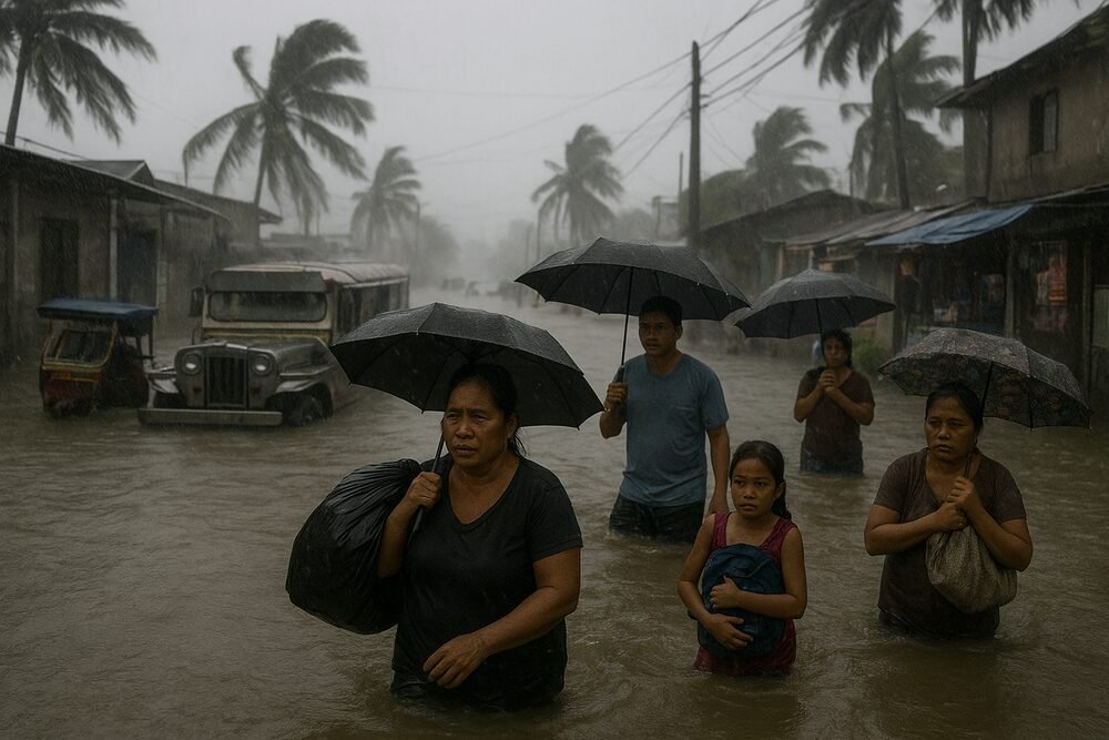
Authorities have cautioned communities in low-lying barangays and mountainous terrain about the possibility of flash floods and landslides, particularly in areas where soil is already saturated by earlier rainfall.
On February 8, flooding was reported in Barangay Sabangan in Caramoran, Catanduanes, underscoring how quickly rising waters can impact riverine and coastal villages.
The National Disaster Risk Reduction and Management Council, along with local government units, is coordinating preparedness efforts under the framework of the National Disaster Risk Reduction and Management Act. Local officials have the authority to suspend classes and mobilize emergency response units as needed.
Disruptions to Daily Life
Beyond the immediate safety risks, the persistent rains are straining transportation and livelihoods.
Ferry operators and fishermen face hazardous sea conditions due to rough coastal waters, potentially leading to canceled trips and income losses. On land, agricultural activity in provinces such as Cagayan, Isabela, Aurora and Quezon may slow as fields become waterlogged.
Outdoor workers — from construction crews to market vendors — are also vulnerable to work stoppages during heavy downpours.
Public health officials often brace for a rise in waterborne illnesses following flooding, while stagnant water can create breeding grounds for disease-carrying mosquitoes.
Amihan Strengthens Its Grip
As of February 20, PAGASA reported that the northeast monsoon remains dominant over Luzon and the Visayas, reinforcing the shear line’s effects. The convergence zone has also been observed extending toward parts of Mindanao.
For residents across eastern Luzon, the coming days are expected to bring more gray skies than sunshine. While the system lacks the dramatic intensity of a typhoon, its steady rains can prove just as disruptive.
Officials continue to urge the public to monitor advisories, avoid flood-prone areas, and heed evacuation orders if issued. In weather patterns like this, the danger often lies not in a single violent burst, but in the quiet persistence of rain that does not let up.
