MANILA, Philippines — Large swaths of Luzon and the Visayas are in for a rain-soaked Monday as a shear line and the northeast monsoon, or amihan, combine to bring cloudy skies, scattered downpours and isolated thunderstorms, according to the Philippine Atmospheric, Geophysical and Astronomical Services Administration (PAGASA).
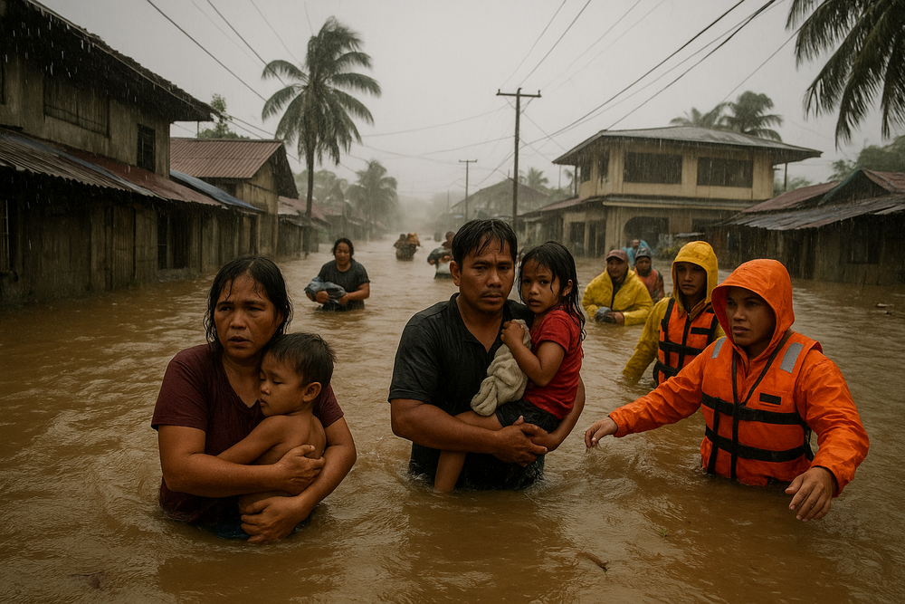
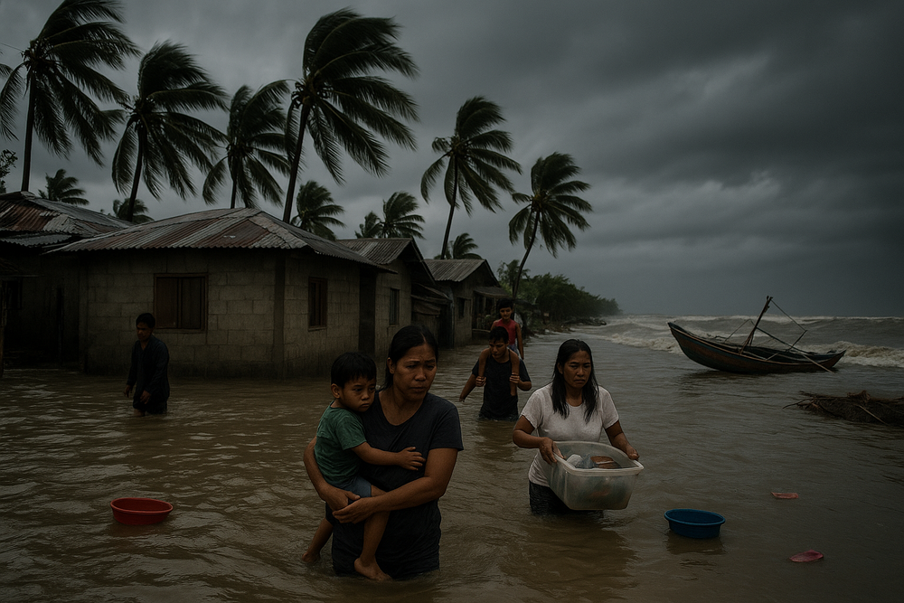
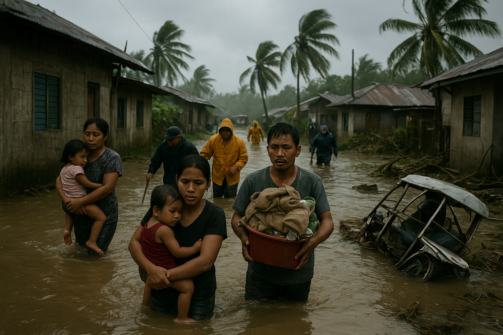
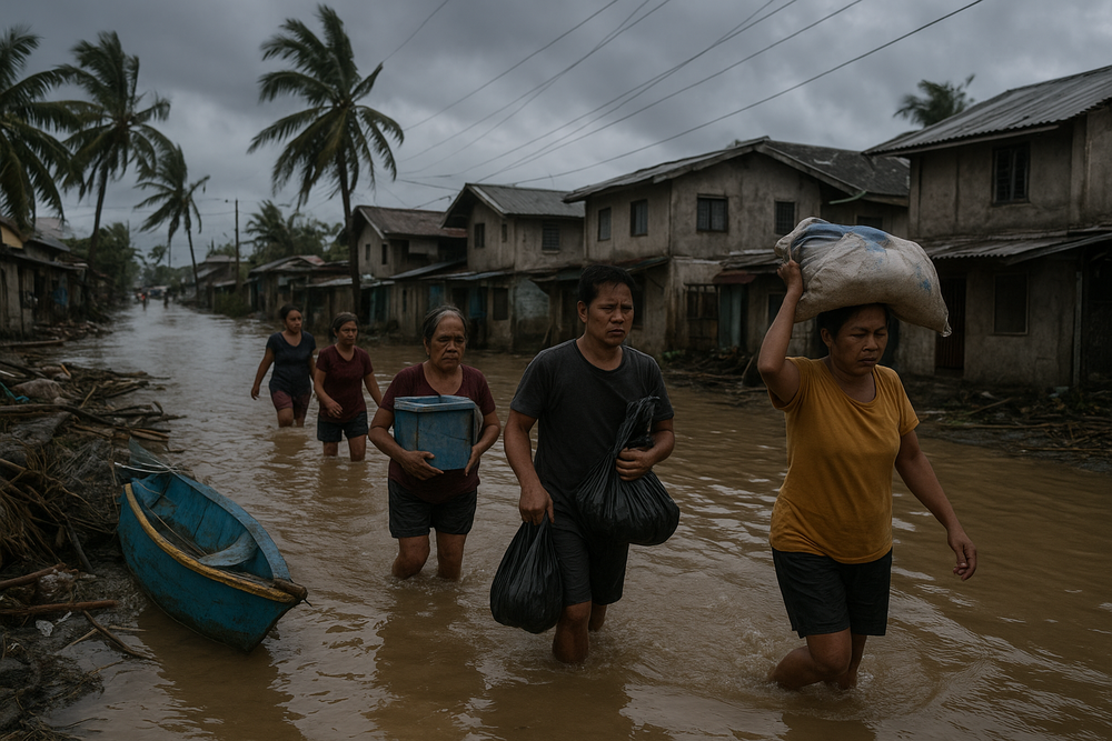
Forecasters warned that 50 to 100 millimeters of rain could drench elevated and exposed areas in Southern Luzon and parts of the Visayas through midweek, raising the risk of flash floods and landslides, particularly in provinces already saturated by earlier rains. No tropical cyclones or low-pressure areas are being tracked, but officials stressed that the convergence of seasonal weather systems is enough to trigger hazards on the ground.
Shear Line Soaks Southern Luzon and Eastern Visayas
The most intense rainfall is concentrated along the shear line — the zone where the cool northeasterly winds of the amihan collide with warm easterlies. The interaction acts like a conveyor belt of moisture, feeding rain clouds over affected regions.
Among the provinces under close watch are Quezon, Aurora, Isabela, Laguna, Rizal, Batangas and Oriental Mindoro in Southern Luzon, as well as the entire Bicol Region — Camarines Norte, Camarines Sur, Catanduanes, Albay, Sorsogon and Masbate. In the Visayas, Northern Samar and Eastern Samar are also expected to receive significant rainfall.
PAGASA said rains that began over the weekend intensified between Sunday and Monday noon, particularly in Quezon, Oriental Mindoro and the Bicol provinces. The wet weather is forecast to persist through at least Wednesday noon, with rain bands shifting gradually across affected areas.
In a recent briefing, PAGASA forecaster Leanne Loreto explained the mechanism driving the downpours. “The initial factor is the shear line, which is the convergence of the northeast monsoon and the easterlies, impacting the eastern parts of southern Luzon,” she said.
Amihan Brings Cooler, Lighter Rains to Northern Luzon
While Southern Luzon and parts of the Visayas bear the brunt of the shear line, the amihan is ushering in partly cloudy to cloudy skies with isolated light rains across Metro Manila, Ilocos Region, Cordillera Administrative Region, Cagayan Valley and Central Luzon, as well as the rest of Luzon.
Moderate to strong northeasterly winds are forecast over Luzon, generating moderate to rough seas along northern and eastern seaboards. Fisherfolk and operators of small vessels were advised to exercise caution, particularly in coastal communities exposed to open waters.
Elsewhere, easterly winds are contributing to scattered rains over Dinagat Islands, Surigao del Norte, Surigao del Sur, Basilan, Sulu and Tawi-Tawi, although impacts there are expected to be isolated.
No Cyclones, But Threats Remain
Despite widespread rainfall, PAGASA emphasized that no storm systems are currently brewing.
“Based on our most recent satellite images, we are not observing any low-pressure systems or storms within or outside our area of responsibility,” Loreto said.
Still, saturated soil conditions heighten the risk of landslides, especially in mountainous areas of Albay, Sorsogon and Samar. Low-lying communities remain vulnerable to flash floods as runoff accumulates quickly during intense bursts of rain.
Under Republic Act No. 10121, local government units are mandated to activate disaster response protocols during severe weather events. Regional and municipal authorities across Bicol and Eastern Visayas have been closely monitoring river levels and drainage systems following localized flooding reported over the weekend.
Daily Life Disrupted
For commuters in Metro Manila and Central Luzon, the amihan-induced rains are expected to slow morning travel, especially during peak hours. In provinces under the shear line, heavy downpours could render some roads impassable, particularly in rural and upland barangays.
Moderate to rough seas along northern and eastern Luzon have also constrained fishing activity, limiting catches and curbing incomes for small-scale fishers. In agricultural communities across Bicol, day laborers face suspended fieldwork, further tightening household budgets already sensitive to fluctuating food prices.
With sunrise recorded at 6:20 a.m. in Metro Manila on Monday, many residents began the day under gray skies — a reminder that even without a named storm, seasonal wind systems can deliver sustained, disruptive rainfall.
Outlook Through Midweek
PAGASA forecasts continued rain through Wednesday, with the heaviest precipitation lingering over Albay, Sorsogon, Northern Samar and Eastern Samar. The shear line’s axis may gradually shift, altering which provinces receive the most persistent downpours.
Authorities urged residents in flood- and landslide-prone areas to remain alert, heed local advisories and prepare for possible evacuations if rainfall intensifies.
For now, forecasters say the conditions are characteristic of the season: a meeting of wind systems that, like tectonic plates in the sky, grind against each other and squeeze out days of rain. The absence of a tropical cyclone offers some reassurance. But as history has shown, it is often the steady, unrelenting rains — not the headlines of a storm — that cause the quietest and most lasting damage.