Signal No. 1 was raised across 14 areas in the central and eastern Philippines on Sunday as Tropical Storm Ada, internationally named Nokaen, maintained its strength and followed an erratic, looping track over the Philippine Sea. While the storm has so far spared the capital region, authorities warned that coastal communities in Eastern Visayas, Caraga and Bicol remain exposed to rough seas, flooding and storm surges.
The Philippine Atmospheric, Geophysical and Astronomical Services Administration (PAGASA) said Ada was last located about 483 kilometres east of Manila, moving northeast at a sluggish 6 kilometres an hour. The storm carries maximum sustained winds of 85 km/h and gusts of up to 105 km/h—strong enough to disrupt livelihoods and transport along the country’s eastern seaboard.
Signals Raised as Storm Lingers Offshore
As of Sunday morning, PAGASA maintained Wind Signal No. 2 over the entire province of Catanduanes, where conditions have already deteriorated sharply. Signal No. 1 covers 14 other areas, mainly in Eastern Visayas—including Samar, Eastern Samar, Biliran and Leyte—and parts of Caraga such as the Dinagat Islands and Agusan del Norte.
The warning system, mandated under the Philippines’ disaster risk reduction law, is designed to give local governments a narrow but crucial window to prepare. In this case, the storm’s looping motion has extended that window, even as it keeps communities on alert.
Catanduanes Bears the Brunt
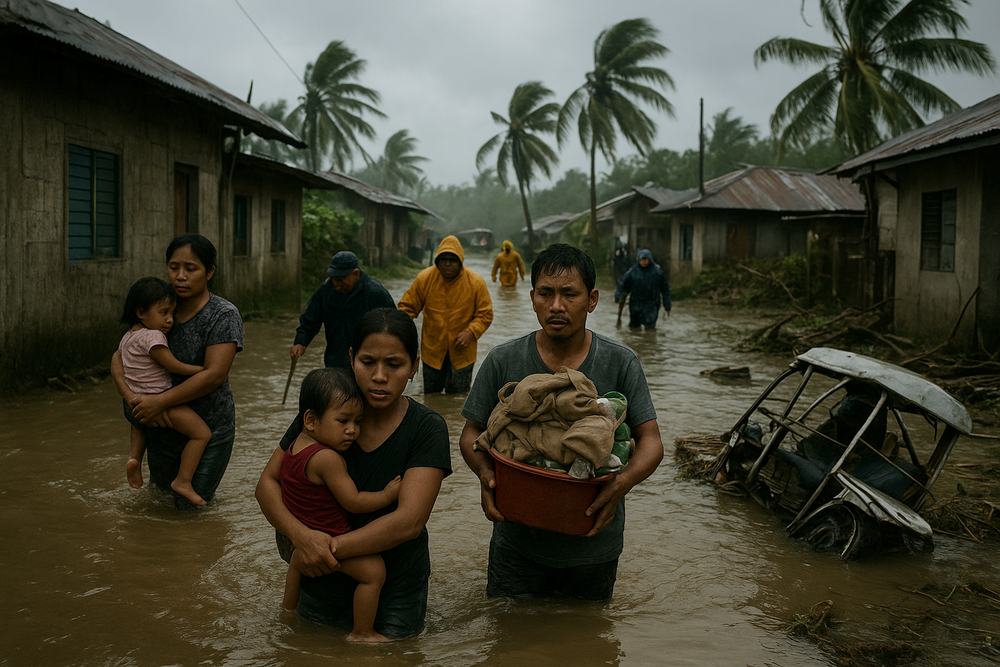
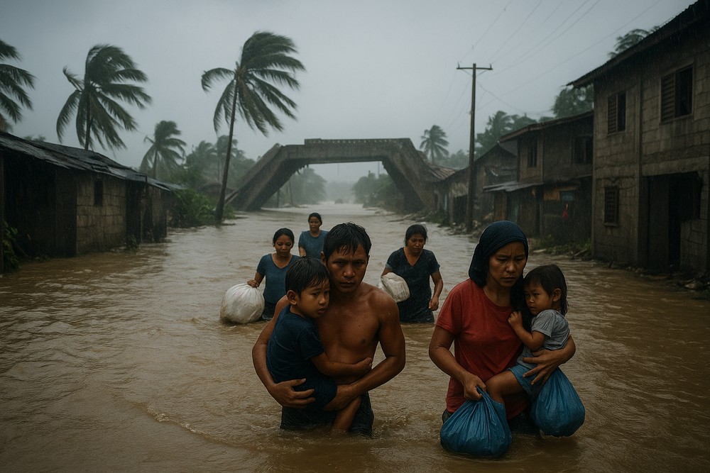
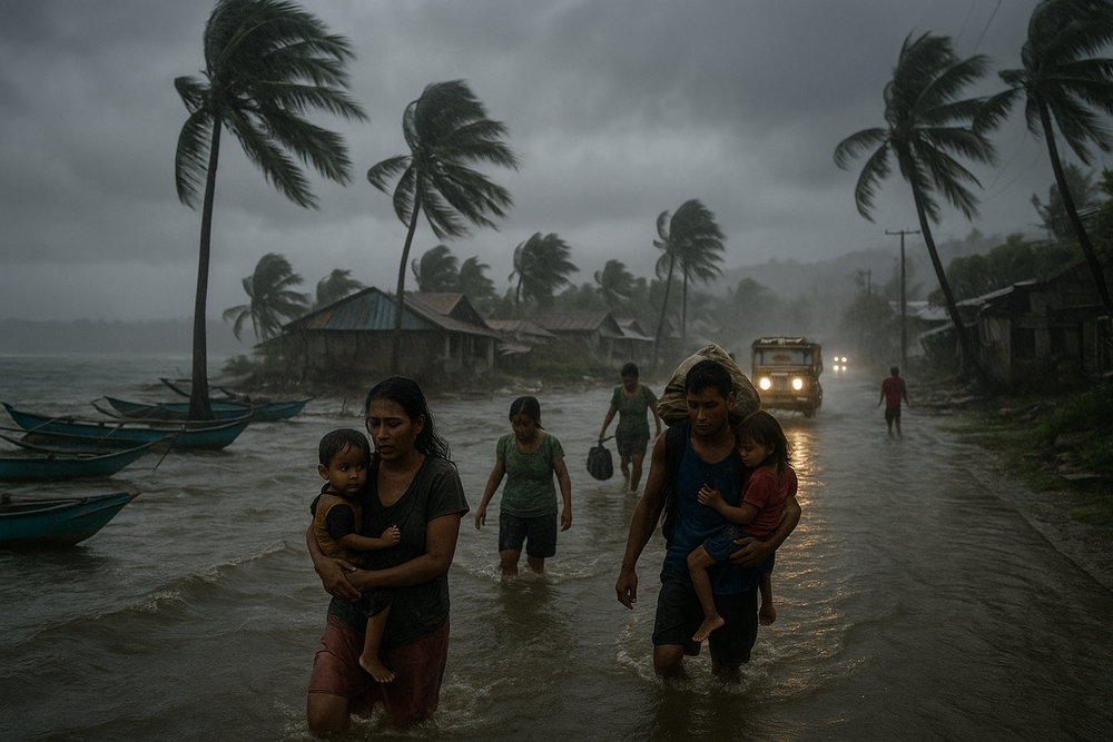
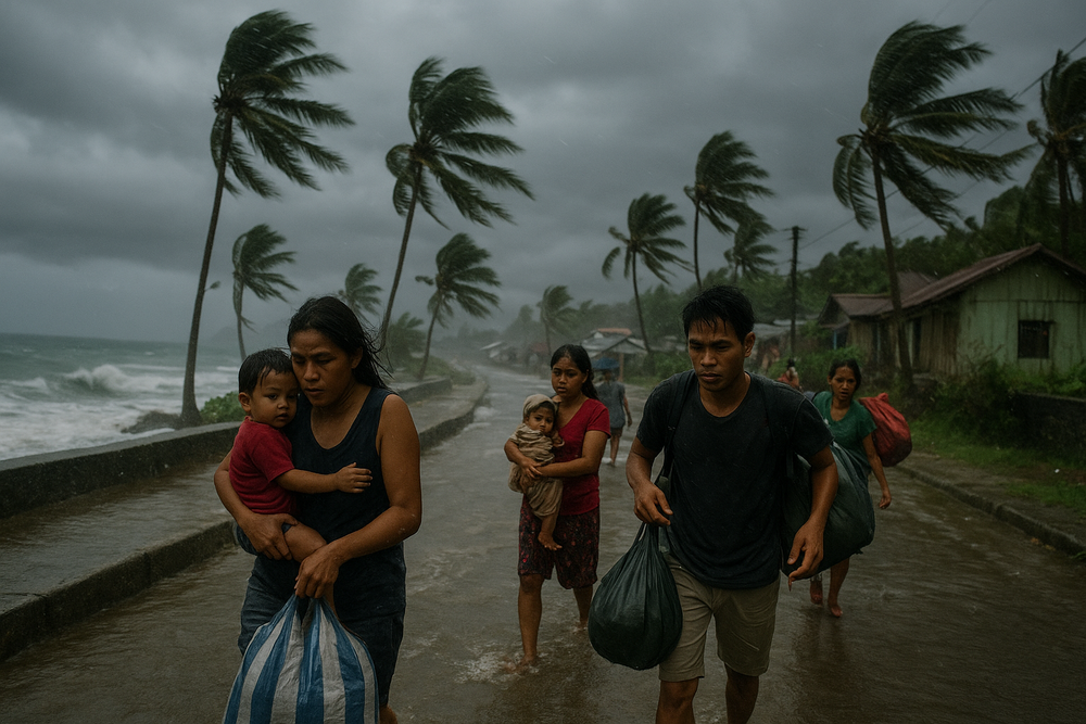
Nowhere has the impact been more visible than in Catanduanes, a Pacific-facing island province accustomed to tempests but ill-equipped for prolonged battering. Local authorities said more than 12,000 families—around 45,000 people—have been evacuated to 185 evacuation centres, many of them schools and municipal halls.
In the towns of Gigmoto and Baras, coastal roads became impassable after waves and debris washed over embankments. Storm surges of 1.5 to 2.0 metres breached dikes and flooded low-lying barangays, forcing fishermen, farmers and market vendors to abandon their homes with little notice.
Provincial officials said evacuations focused on areas along the Sagñay coastline and communities bordering Tiwi and Garchitorena, where the sea met the land “like a hammer to glass”, leaving little to withstand the force.
Communities Along the Pacific on Alert
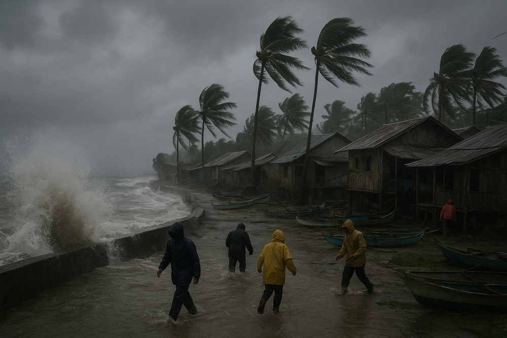
Beyond Catanduanes, PAGASA warned of storm surges of up to 1.5 metres in coastal parts of Bicol, Eastern Visayas and Caraga, especially those facing the Pacific Ocean. In some towns, even smaller surges can contaminate fish catch, flood homes and halt small boats that serve as floating workplaces.
During a prior briefing, PAGASA weather specialist Benison Estareja said warnings extended across several regions. “Simula ngayong tanghali hanggang bukas ng tanghali over Catanduanes, Albay, Sorsogon, Samar, Biliran, down to Leyte… posible pa ring makaranas [ng signals] Camarines Norte, Camarines Sur and Catanduanes,” he said.
PAGASA added that coastal communities in Camarines Sur, Albay, Sorsogon, Masbate, Northern Samar, Samar, Eastern Samar, Biliran, Leyte and the Dinagat Islands could face dangerous seas, particularly those directly exposed to the Pacific.
A Slow, Uncertain Track
Forecasters described Ada’s movement as hesitant, almost circular—less a sprint than a slow turn on wet pavement. This looping track, while limiting how far inland the storm penetrates, increases the duration of rainfall and coastal stress.
PAGASA said wind signals could still be raised in parts of Camarines Norte, Camarines Sur, Albay and Sorsogon through Monday, before the storm is expected to recurve away from land by midday. But officials cautioned that sudden changes in direction or intensity remain possible.
Economic Strain on the “Masa”
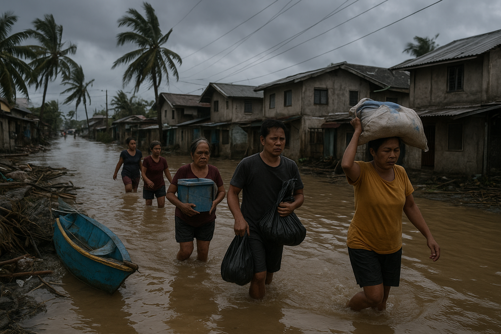
For ordinary households, the storm’s true cost is often felt long after the rain ends. Fishing has halted across wide stretches of the eastern coast, depriving coastal families of daily income. Studies show that cyclone-related rains can reduce fisherfolk earnings by nearly a third over a year, a loss few can absorb.
On land, flooded roads in Catanduanes have stranded daily wage earners, farmers and traders. In evacuation centres, families crowd into limited space, heightening concerns over food supplies and health. Past storms have triggered sudden price jumps for staples such as eggs and rice, stretching remittances sent by relatives working in cities.
A Familiar Test for a Storm-Prone Nation
The Philippines endures an average of 20 tropical cyclones each year, with eight or nine making landfall. While many storms cause limited physical damage, their cumulative effect quietly erodes local economies, shaving an estimated 1 per cent from economic activity in affected areas.
Authorities insist that early warnings and pre-emptive evacuations remain the most effective defence. For communities along the Pacific rim, Tropical Storm Ada is another reminder that even modest storms can upend lives when geography, poverty and the sea converge.