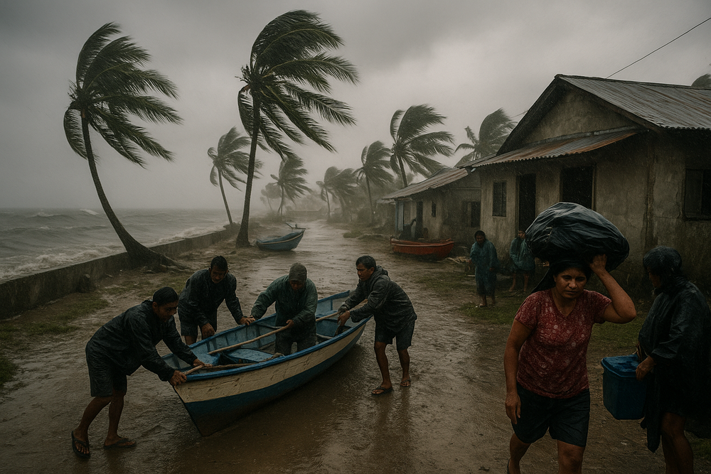
The Philippine Atmospheric, Geophysical and Astronomical Services Administration (PAGASA) raised Storm Signal No. 1 in six areas across Visayas and Mindanao on January 15, 2026, in response to Tropical Depression Ada, the first tropical cyclone of the year known internationally as Nokaen. While the system is not expected to make landfall, its intensification into a tropical storm has triggered warnings for heavy rainfall, rough seas reaching up to four meters, and possible lahar flows near Mayon Volcano, prompting heightened vigilance among local government units and coastal communities.
Tropical Storm Ada Steadies Its Course East of Eastern Visayas
As of 5:00 a.m. on January 16, Tropical Storm Ada was located approximately 370 kilometers east of Surigao City, carrying sustained winds of up to 65 kilometers per hour with gusts peaking at 80 kilometers per hour. Moving at a slow north-northwest pace, the storm’s path is expected to shift northwestward before veering northeast, eventually dissipating by January 20. PAGASA forecasts a gradual intensification within 48 hours over the Philippine Sea, with possible escalation to Signal No. 2 in some coastal areas before the storm weakens.
Six Areas Under Signal No. 1 as Precautionary Measures Intensify
The tropical cyclone wind signal was hoisted over the provinces of Catanduanes, Albay, Sorsogon, Samar, Biliran, and Leyte, marking official warnings against anticipated wind speeds between 30 to 60 kilometers per hour and associated weather disturbances. These alerts advise residents and local governments to prepare for potential hazards, including:
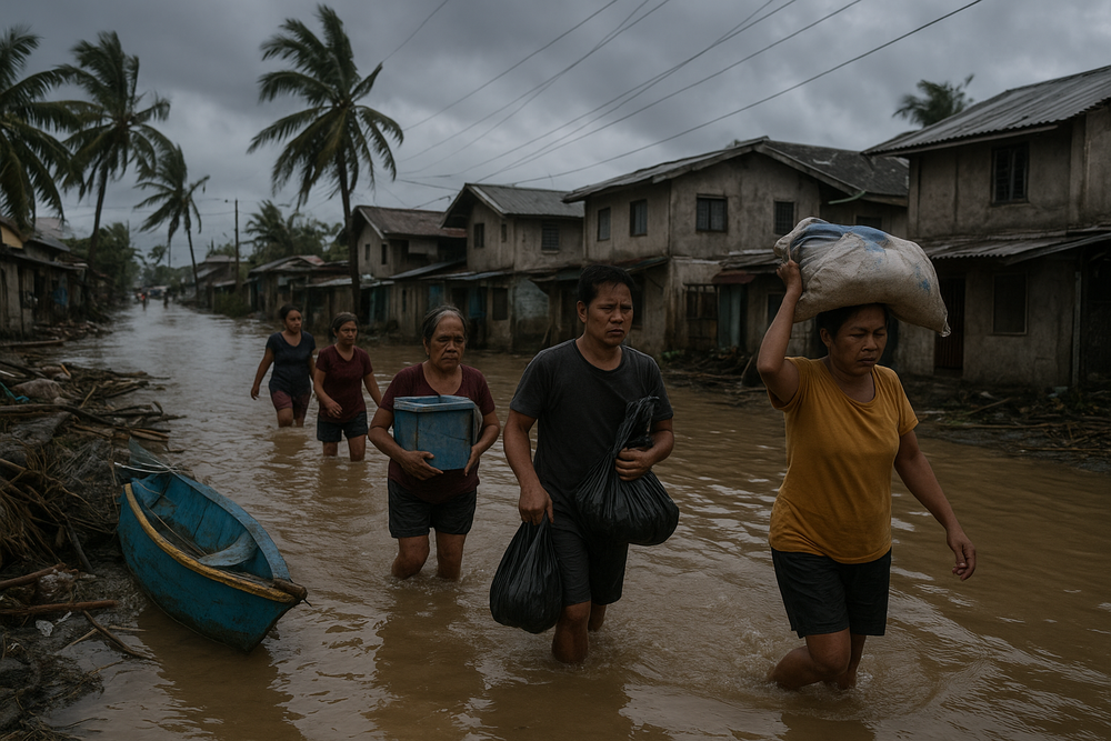
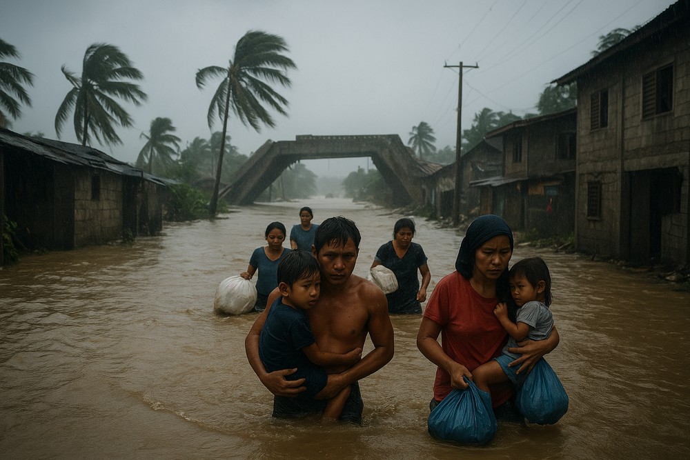
- Heavy rains that may cause flooding and landslides, especially in vulnerable, low-lying, and mountainous barangays
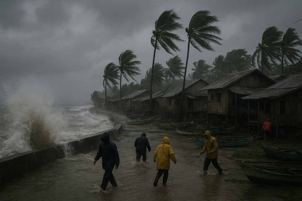
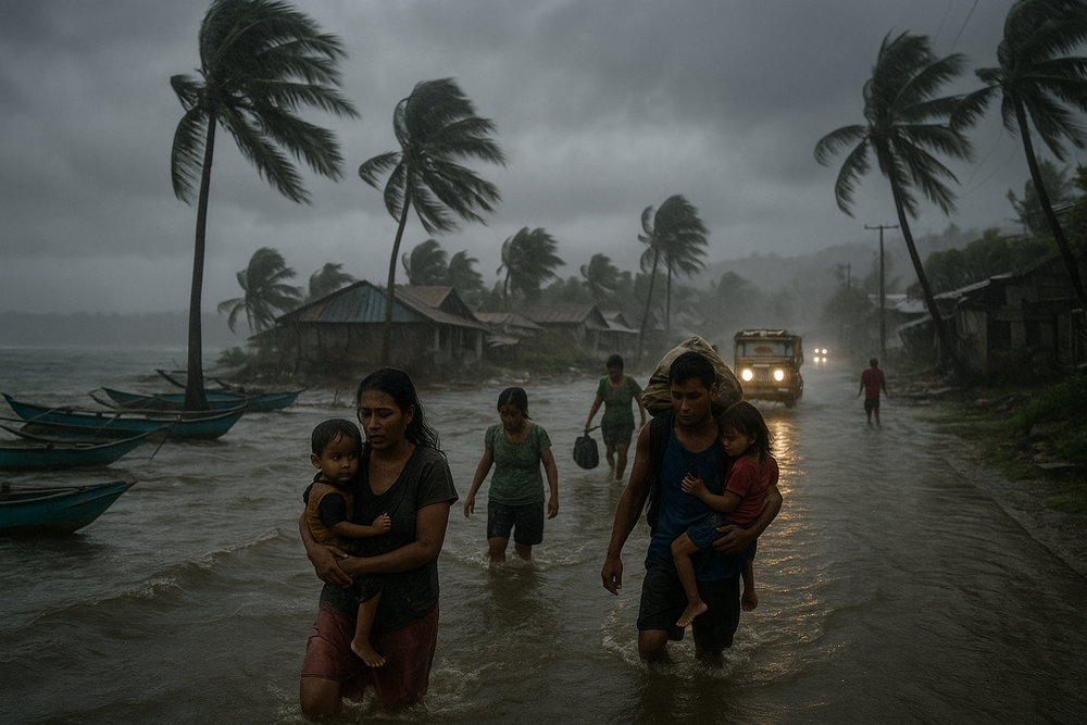
- Rough seas up to 4 meters, hampering fishing activities and marine travel along northern and eastern coasts
- Lahar risks around Mayon Volcano noted particularly for Camarines Norte, Camarines Sur, and Catanduanes, reinforcing evacuation priorities
Beyond the initial six areas, wider regions including Northern Samar, Eastern Samar, Southern Leyte, Dinagat Islands, and Siargao have observed varying levels of weather disturbances related to Ada’s influence.
Government Response and Preparedness Efforts
At the forefront, PAGASA’s weather specialists emphasize proactive communication and rigorous monitoring. Speaking on January 16, PAGASA meteorologist Benison Estareja underscored the importance of precautionary measures: “Coastal communities in Camarines Sur, Catanduanes, Albay, Sorsogon, Masbate, Northern Samar, Samar, Eastern Samar, Biliran, Leyte, and Dinagat Islands, especially those facing the Pacific, must remain vigilant.”
Local government units within the affected areas have initiated suspensions of classes and preparations for possible evacuations in flood- and landslide-prone communities. Notably, schools in Cebu have temporarily shut, reflecting broader disruptions to daily life in the Visayas and parts of Mindanao. Meanwhile, agencies such as the National Disaster Risk Reduction and Management Council (NDRRMC) coordinate closely with LGUs and PAGASA to ensure readiness and timely response.
Impact on Coastal Communities and the Maritime Sector
Fishing communities along the Pacific-facing coastlines from Camarines Sur to Dinagat Islands face immediate economic setbacks as four-meter-high waves prevent small vessels from venturing out to sea. This seasonal disruption compounds already significant cyclone-related livelihood losses, which research indicates can diminish annual incomes from fishing by up to 31.8% in hard-hit locales.
Beyond the direct storm hazards, gale-force winds driven by both Ada’s circulation and the northeast monsoon have heightened risk factors across a broader swath of regions—including Ilocos Norte, Occidental Mindoro, Palawan, Bicol, and Caraga. These conditions threaten transportation, supply chains, and ultimately the stability of local markets relying on agricultural and fishery products.
Scientific Context and Long-Term Concerns
The Philippines experiences an average of 20 tropical cyclones annually, with 8 to 9 typically making landfall. Ada is the country’s first named storm of the 2026 season, illustrating early activity in the Philippine Sea. PAGASA’s warning framework, particularly the Tropical Cyclone Wind Signals (TCWS), plays an essential role in minimizing risk by informing both the public and disaster management authorities.
A study by Climate Analytics highlights the broader vulnerability of Filipino households to climate-related events, noting significant income reductions tied to increasingly frequent and intense storms. The report warns that, despite international agreements like the Paris Agreement, local communities remain exposed to escalating risks that challenge economic resilience and disaster preparedness.
Looking Ahead: Vigilance Amid Uncertainty
While Ada is not expected to make landfall, its trajectory and sustained intensity still pose significant threats through flooding, landslides, and maritime hazards. PAGASA continues to monitor the system closely, advising residents and LGUs to uphold heightened caution, particularly in identified flood-prone and volcanic lahar zones.
As the storm moves gradually across the Philippine Sea, authorities are poised to update warnings and adjust safety measures accordingly. For coastal families and vulnerable communities, Storm Signal No. 1 serves as a crucial reminder of nature’s caprice and the perpetual need for readiness in the face of climatic volatility.