Widespread rainfall continues to sweep across much of the Philippines this week as the combined effects of the northeast monsoon, a shear line, and the lingering remnants of Tropical Depression Wilma disrupt daily life and displace thousands. Authorities have issued multiple weather warnings as flooding, landslides, and rough seas threaten vulnerable communities—particularly in Luzon, Visayas, and parts of Mindanao.
Rainfall Triggers Flooding in 31 Areas Nationwide
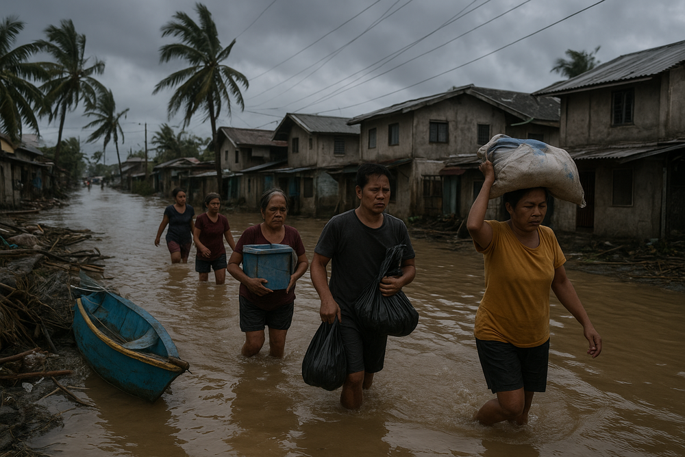
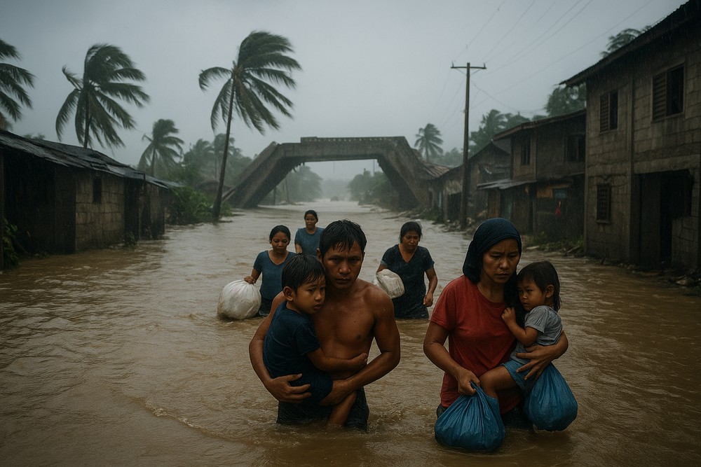
As of early December, flooding has been reported in 31 locations across the country. Among the hardest-hit regions are Calabarzon, Mimaropa, Bicol, Eastern Visayas, and Caraga. While floodwaters have begun to recede in parts of Calabarzon and Caraga, several communities in Bicol and Eastern Visayas remain inundated.
According to the National Disaster Risk Reduction and Management Council (NDRRMC), over 132,000 people—approximately 47,177 families—have been affected by days of relentless rain. The worst impact has been felt in Region 8 (Eastern Visayas), where flooding has disrupted the lives of more than 57,000 residents. In Central Visayas and the Bicol Region, another 53,000 and 21,500 individuals respectively are grappling with storm-related challenges.
Thousands Displaced and Transport Disrupted
More than 22,600 people have sought shelter in 193 evacuation centers set up across affected regions. While no fatalities have been reported, preliminary assessments indicate partial damage to three homes, and 15 road segments have been rendered impassable due to floodwaters and landslides.
The impact has extended to maritime transport. Operations at 135 seaports have been significantly disrupted, halting the movement of cargo, passengers, and vessels—an especially troubling development during the busy pre-holiday travel period.
Weather Systems Behind the Deluge
The ongoing precipitation is being driven by a trio of converging meteorological forces. The northeast monsoon, locally known as “amihan”, typically ushers in cooler air from Siberia, but this season it is carrying excess moisture that contributes to widespread rain, particularly in northern Luzon and eastern provinces.
Compounding this system is a shear line—a boundary where converging wind patterns meet, creating instability in the atmosphere. This phenomenon enhances cloud development, further increasing rainfall in vulnerable areas. The persistent influence of the low pressure area (LPA) that evolved from Tropical Depression Wilma continues to feed precipitation into the Philippines, particularly across the Visayas and portions of Luzon.
Rainfall Outlook: High Volumes and Continued Risks
Forecast models predict intense rainfall in key areas through the beginning of the week. Regions including Northern Samar, Eastern Samar, Leyte, Albay, Sorsogon, and Masbate may experience 100–200 mm of rain on peak days—volumes capable of triggering flash floods and landslides. Moderate rainfall of 50–100 mm is expected in Camarines Sur, Iloilo, Quezon, Mindoro, and other provinces.
The Philippine Atmospheric, Geophysical and Astronomical Services Administration (PAGASA) confirms that the shear line and amihan rains are expected to weaken by midweek but warns of a potential resurgence. The low-pressure area near Culasi, Antique is being monitored closely, with forecasts suggesting a chance of re-intensification within the next 24 to 48 hours.
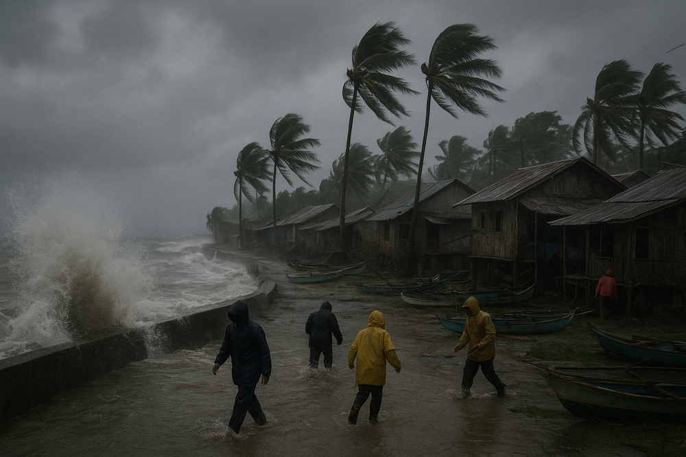
Strong Winds and Rough Seas Along Eastern Coasts
Eastern Luzon is already experiencing gale-force winds driven by the enhanced northeast monsoon, generating dangerous sea conditions. PAGASA has reaffirmed warnings for fishermen and coastal communities due to rough to very rough coastal waters. Other regions are also contending with brisk winds and varied sea states, complicating both livelihoods and rescue efforts.
La Niña, Climate Change, and Broader Vulnerability
The Philippines’ volatile weather this year falls against the backdrop of a strengthening La Niña event, which has historically increased rainfall and reduced atmospheric resistance to tropical cyclone formation. This climatic driver is partially responsible for the intense and prolonged wet conditions observed in 2025.
Climate experts from the UN Economic and Social Commission for Asia and the Pacific (ESCAP) have warned that rising sea surface temperatures and rapid urban development are exacerbating the country’s exposure to hydrometeorological hazards. Although early warning systems have helped reduce casualties, the Philippines’ aging infrastructure remains a critical point of vulnerability.
Chronology of Recent Weather Events
- December 4: Formation of a low-pressure area that evolved into Tropical Depression Wilma east of Eastern Visayas.
- December 5–7: Wilma tracked west-southwest, bringing torrential rains to the Visayas before weakening into an LPA.
- December 7–8: Combined effects of the northeast monsoon, shear line, and Wilma’s remnants brought high-impact rainfall across Luzon, Visayas, and northern Mindanao.
- December 8: New forecasts point to easing monsoon winds midweek, though future surges remain possible later in the week.
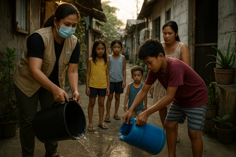
Relief Efforts and Urgent Warnings
The NDRRMC announced that government agencies have already provided assistance worth P885,290 to families in evacuation centers. Local governments have been tasked with maintaining readiness for additional flooding and landslides, especially in areas already saturated by earlier storms.
Weather authorities continue to monitor the potential redevelopment of the Wilma remnant system and advise residents to stay updated as conditions evolve.
Preparedness Over Complacency
With structural vulnerabilities exposed and more rains on the horizon, Philippine localities are bracing for ongoing challenges. As rains drench the landscape and evacuation shelters remain filled, officials are doubling down on calls for community vigilance, early response planning, and adherence to local advisories.
The convergence of meteorological forces this week is more than a passing storm—it is a sharp reminder of the country’s deepening climate fragility and the urgent need for resilient infrastructure and disaster preparedness.